Balagon geodata
Balagon (Zamboanga Peninsula) is a populated place; located in Philippines in Asia/Manila (GMT+8) time zone. With population of 2,691 people, there are 2960 cities with bigger population in this country. Compared to other cities in Philippines, 82.7% of cities are located further ↑North; 57.2% of cities are located further ←West and 96.5% of cities have lower elevation than Balagon. Note1
Administrative division(s):
- Level 1: Zamboanga Peninsula
- Level 2: Province of Zamboanga del Sur
- Level 3: Midsalip


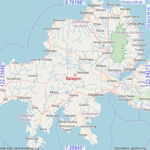
Balagon GPS coordinates[2]
8° 0' 22.68" North, 123° 14' 22.56" East
| Map corner | latitude | longitude |
|---|---|---|
| Upper-left | 8.70196°, | 122.53648° |
| Center: | 8.0063°, | 123.2396° |
| Lower-right: | 7.30945°, | 123.94273° |
| Map W x H: | 154.8×154.8 km | = 96.2×96.2mi |
| max Lat: | 20.78733° ⇑82.7% North |
| Balagon: | 8.0063° |
| min Lat: | ⇓17.3% South 4.65442° |
| min Long | Balagon | max Long |
| 117.04868° | 123.2396° | 126.58417° |
| W 57.2%⇐ | ⇒42.8% E |
Elevation
Elevation of Balagon is 545 m = 1788 ft, and this is 457.1 m = 1500 ft above average elevation for this country.
| Max E: |
2262 m = 7421 ft | 3.5% |
| Balagon | 545 m 1788 ft | |
| Avg. | 87.9 m = 288 ft | |
Min E: |
-2 m = -7 ft | 96.5% |
See also: Philippines elevation on elevation.city.
Geographical zone
Balagon is located in North Torrid zone (between Equator and Tropic of Cancer). Distance of Equator is 890.2 km =553.1 mi to South.| Distance of | km | miles | from Balagon |
|---|---|---|---|
| North Pole | 9116.8 | 5664.9 | to North |
| Arctic Circle | 6511 | 4045.7 | to North |
| Tropic Cancer | 1715.7 | 1066.1 | to North |
| Equator | 890.2 | 553.1 | to South |


Nearby cities:
15 places around Balagon: (largest is in red/bold)
• Bayog
24.6 km =15.3 mi,  230°
230°
• Danlugan
19.5 km =12.1 mi,  131°
131°
• Dipolo
28.3 km =17.6 mi,  208°
208°
• Dumalinao
25.3 km =15.7 mi,  145°
145°
• Dumingag
21.8 km =13.5 mi,  33°
33°
• Kagawasan
23.1 km =14.4 mi, 132°
• Kumalarang
30.6 km =19 mi,  200°
200°
• Mahayag
25.9 km =16.1 mi,  61°
61°
• Midsalip
3.1 km =1.9 mi,  103°
103°
• Molave
29 km =18 mi,  72°
72°
• Pagadian
29.6 km =18.4 mi, 132°
• Ramon Magsaysay
29.7 km =18.5 mi,  90°
90°
• Rancheria Payau
19.1 km =11.9 mi, 207°
• Tawagan
31.5 km =19.6 mi,  124°
124°
• Timonan
29.6 km =18.4 mi,  320°
320°
Sources, notices
• [Note1] Compared only with cities in Philippines existing in our database
• [Src1] Map data: © OpenStreetMap contributors (CC-BY-SA)
• [Src2] Other city data from geonames.org with taken over terms of usage.
• [Src3] Geographical zone / Annual Mean Temperature by Robert A. Rohde @ Wikipedia
