Bacuyangan geodata
Bacuyangan (Western Visayas) is a populated place; located in Philippines in Asia/Manila (GMT+8) time zone. With population of 7,506 people, there are 824 cities with bigger population in this country. Compared to other cities in Philippines, 72.2% of cities are located further ↑North; 55.3% of cities are located further →East and 60.8% of cities have higher elevation than Bacuyangan. Note1
Administrative division(s):
- Level 1: Western Visayas
- Level 2: Province of Negros Occidental
- Level 3: Hinoba-An


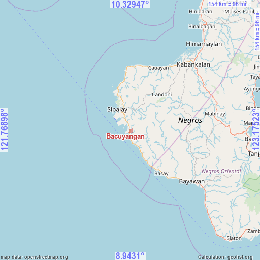
Bacuyangan GPS coordinates[2]
9° 38' 13.2" North, 122° 28' 19.56" East
| Map corner | latitude | longitude |
|---|---|---|
| Upper-left | 10.32947°, | 121.76898° |
| Center: | 9.637°, | 122.4721° |
| Lower-right: | 8.9431°, | 123.17523° |
| Map W x H: | 154.1×154.2 km | = 95.8×95.8mi |
| max Lat: | 20.78733° ⇑72.2% North |
| Bacuyangan: | 9.637° |
| min Lat: | ⇓27.8% South 4.65442° |
| min Long | Bacuyangan | max Long |
| 117.04868° | 122.4721° | 126.58417° |
| W 44.7%⇐ | ⇒55.3% E |
Elevation
Elevation of Bacuyangan is 16 m = 52 ft, and this is 71.9 m = 236 ft below average elevation for this country.
| Max E: |
2262 m = 7421 ft | 60.8% |
| Avg. | 87.9 m = 288 ft | |
| Bacuyangan | 16 m = 52 ft | |
Min E: |
-2 m = -7 ft | 39.2% |
See also: Philippines elevation on elevation.city.
Geographical zone
Bacuyangan is located in North Torrid zone (between Equator and Tropic of Cancer). Distance of Equator is 1071.5 km =665.8 mi to South.| Distance of | km | miles | from Bacuyangan |
|---|---|---|---|
| North Pole | 8935.5 | 5552.3 | to North |
| Arctic Circle | 6329.6 | 3933 | to North |
| Tropic Cancer | 1534.4 | 953.4 | to North |
| Equator | 1071.5 | 665.8 | to South |


Nearby cities:
15 places around Bacuyangan: (largest is in red/bold)
• Alim
8.2 km =5.1 mi,  168°
168°
• Asia
10.8 km =6.7 mi,  153°
153°
• Bal-os
27.5 km =17.1 mi,  142°
142°
• Bulata
26 km =16.2 mi,  342°
342°
• Cabadiangan
12.9 km =8 mi,  0°
0°
• Candoni
24.7 km =15.3 mi,  35°
35°
• Caningay
28.5 km =17.7 mi, 41°
• Canturay
17.5 km =10.9 mi,  353°
353°
• Cartagena
21.8 km =13.5 mi, 338°
• Cayhagan
6.2 km =3.9 mi,  317°
317°
• Colipapa
20.7 km =12.9 mi, 151°
• Manlucahoc
11.8 km =7.3 mi,  13°
13°
• Maricalom
9.5 km =5.9 mi, 322°
• Nabulao
3.2 km =2 mi,  330°
330°
• Sipalay
14.8 km =9.2 mi, 329°
Sources, notices
• [Note1] Compared only with cities in Philippines existing in our database
• [Src1] Map data: © OpenStreetMap contributors (CC-BY-SA)
• [Src2] Other city data from geonames.org with taken over terms of usage.
• [Src3] Geographical zone / Annual Mean Temperature by Robert A. Rohde @ Wikipedia
