Ayungon geodata
Ayungon (Central Visayas) is a seat of a third-order administrative division; located in Philippines in Asia/Manila (GMT+8) time zone. In our database, there are 4166 cities with bigger population. Compared to other cities in Philippines, 69.8% of cities are located further ↑North; 55.7% of cities are located further ←West and 89.7% of cities have higher elevation than Ayungon. Note1
Administrative division(s):
- Level 1: Central Visayas
- Level 2: Province of Negros Oriental
- Level 3: Ayungon


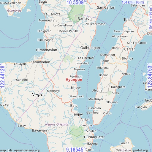
Ayungon GPS coordinates[2]
9° 51' 32.04" North, 123° 8' 39.84" East
| Map corner | latitude | longitude |
|---|---|---|
| Upper-left | 10.5509°, | 122.44128° |
| Center: | 9.8589°, | 123.1444° |
| Lower-right: | 9.16545°, | 123.84753° |
| Map W x H: | 154×154.1 km | = 95.7×95.8mi |
| max Lat: | 20.78733° ⇑69.8% North |
| Ayungon: | 9.8589° |
| min Lat: | ⇓30.2% South 4.65442° |
| min Long | Ayungon | max Long |
| 117.04868° | 123.1444° | 126.58417° |
| W 55.7%⇐ | ⇒44.3% E |
Elevation
Elevation of Ayungon is 7 m = 23 ft, and this is 80.9 m = 265 ft below average elevation for this country.
| Max E: |
2262 m = 7421 ft | 89.7% |
| Avg. | 87.9 m = 288 ft | |
| Ayungon | 7 m = 23 ft | |
Min E: |
-2 m = -7 ft | 10.3% |
See also: Philippines elevation on elevation.city.
Geographical zone
Ayungon is located in North Torrid zone (between Equator and Tropic of Cancer). Distance of Equator is 1096.2 km =681.1 mi to South.| Distance of | km | miles | from Ayungon |
|---|---|---|---|
| North Pole | 8910.9 | 5537 | to North |
| Arctic Circle | 6305 | 3917.7 | to North |
| Tropic Cancer | 1509.7 | 938.1 | to North |
| Equator | 1096.2 | 681.1 | to South |


Nearby cities:
15 places around Ayungon: (largest is in red/bold)
• Amdos
5.8 km =3.6 mi,  296°
296°
• Bolisong
18.7 km =11.6 mi,  177°
177°
• Bulod
19.5 km =12.1 mi, 178°
• Campoyo
22.5 km =14 mi, 179°
• Jimalalud
14.7 km =9.1 mi,  24°
24°
• Kandabong
20.8 km =12.9 mi,  202°
202°
• La Libertad
21 km =13 mi,  27°
27°
• Nalundan
14.8 km =9.2 mi,  215°
215°
• Payabon
11.1 km =6.9 mi, 181°
• Tambalan
8.2 km =5.1 mi,  312°
312°
• Tambo
10.5 km =6.5 mi,  292°
292°
• Tampocon
1.6 km =1 mi,  230°
230°
• Tayasan
7.8 km =4.8 mi, 21°
• Tiguib
6.5 km =4 mi,  188°
188°
• Tinaogan
8.9 km =5.5 mi, 175°
Sources, notices
• [Note1] Compared only with cities in Philippines existing in our database
• [Src1] Map data: © OpenStreetMap contributors (CC-BY-SA)
• [Src2] Other city data from geonames.org with taken over terms of usage.
• [Src3] Geographical zone / Annual Mean Temperature by Robert A. Rohde @ Wikipedia
