Payabon geodata
Payabon (Central Visayas) is a populated place; located in Philippines in Asia/Manila (GMT+8) time zone. With population of 3,600 people, there are 1982 cities with bigger population in this country. Compared to other cities in Philippines, 70.9% of cities are located further ↑North; 55.6% of cities are located further ←West and 56.1% of cities have higher elevation than Payabon. Note1
Administrative division(s):
- Level 1: Central Visayas
- Level 2: Province of Negros Oriental
- Level 3: Bindoy (Payabon)


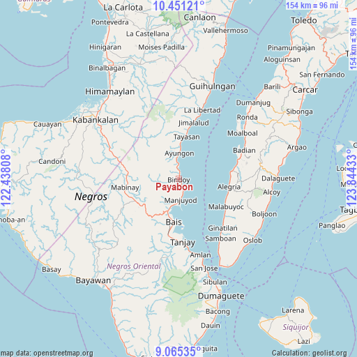
Payabon GPS coordinates[2]
9° 45' 32.4" North, 123° 8' 28.32" East
| Map corner | latitude | longitude |
|---|---|---|
| Upper-left | 10.45121°, | 122.43808° |
| Center: | 9.759°, | 123.1412° |
| Lower-right: | 9.06535°, | 123.84433° |
| Map W x H: | 154.1×154.1 km | = 95.8×95.8mi |
| max Lat: | 20.78733° ⇑70.9% North |
| Payabon: | 9.759° |
| min Lat: | ⇓29.1% South 4.65442° |
| min Long | Payabon | max Long |
| 117.04868° | 123.1412° | 126.58417° |
| W 55.6%⇐ | ⇒44.4% E |
Elevation
Elevation of Payabon is 19 m = 62 ft, and this is 68.9 m = 226 ft below average elevation for this country.
| Max E: |
2262 m = 7421 ft | 56.1% |
| Avg. | 87.9 m = 288 ft | |
| Payabon | 19 m = 62 ft | |
Min E: |
-2 m = -7 ft | 43.9% |
See also: Philippines elevation on elevation.city.
Geographical zone
Payabon is located in North Torrid zone (between Equator and Tropic of Cancer). Distance of Equator is 1085.1 km =674.2 mi to South.| Distance of | km | miles | from Payabon |
|---|---|---|---|
| North Pole | 8922 | 5543.9 | to North |
| Arctic Circle | 6316.1 | 3924.6 | to North |
| Tropic Cancer | 1520.8 | 945 | to North |
| Equator | 1085.1 | 674.2 | to South |


Nearby cities:
15 places around Payabon: (largest is in red/bold)
• Alangilanan
13.6 km =8.5 mi,  196°
196°
• Amdos
14.5 km =9 mi,  340°
340°
• Ayungon
11.1 km =6.9 mi,  1°
1°
• Bagtic
16.3 km =10.1 mi,  240°
240°
• Bolisong
7.6 km =4.7 mi,  171°
171°
• Bulod
8.5 km =5.3 mi, 173°
• Campoyo
11.4 km =7.1 mi,  176°
176°
• Kandabong
11.1 km =6.9 mi,  222°
222°
• Nalundan
8.2 km =5.1 mi,  263°
263°
• Tambalan
17.6 km =10.9 mi, 341°
• Tambo
17.8 km =11.1 mi,  328°
328°
• Tamiso
15.4 km =9.6 mi, 202°
• Tampocon
10.2 km =6.3 mi,  355°
355°
• Tiguib
4.7 km =2.9 mi,  351°
351°
• Tinaogan
2.4 km =1.5 mi,  24°
24°
Sources, notices
• [Note1] Compared only with cities in Philippines existing in our database
• [Src1] Map data: © OpenStreetMap contributors (CC-BY-SA)
• [Src2] Other city data from geonames.org with taken over terms of usage.
• [Src3] Geographical zone / Annual Mean Temperature by Robert A. Rohde @ Wikipedia
