Arminia geodata
Arminia (Central Luzon) is a populated place; located in Philippines in Asia/Manila (GMT+8) time zone. With population of 3,468 people, there are 2082 cities with bigger population in this country. Compared to other cities in Philippines, 81.1% of cities are located further ↓South; 89.3% of cities are located further →East and 74.3% of cities have lower elevation than Arminia. Note1
Administrative division(s):
- Level 1: Central Luzon
- Level 2: Province of Tarlac
- Level 3: City of Tarlac


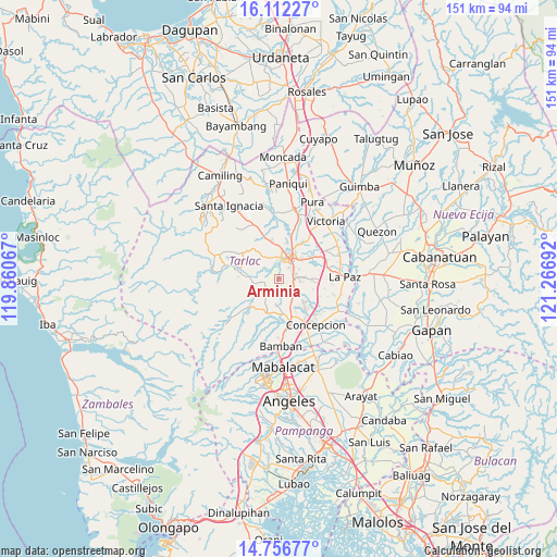
Arminia GPS coordinates[2]
15° 26' 8.268" North, 120° 33' 49.644" East
| Map corner | latitude | longitude |
|---|---|---|
| Upper-left | 16.11227°, | 119.86067° |
| Center: | 15.43563°, | 120.56379° |
| Lower-right: | 14.75677°, | 121.26692° |
| Map W x H: | 150.7×150.7 km | = 93.6×93.6mi |
| max Lat: | 20.78733° ⇑18.9% North |
| Arminia: | 15.43563° |
| min Lat: | ⇓81.1% South 4.65442° |
| min Long | Arminia | max Long |
| 117.04868° | 120.56379° | 126.58417° |
| W 10.7%⇐ | ⇒89.3% E |
Elevation
Elevation of Arminia is 66 m = 217 ft, and this is 21.9 m = 72 ft below average elevation for this country.
| Max E: |
2262 m = 7421 ft | 25.7% |
| Avg. | 87.9 m = 288 ft | |
| Arminia | 66 m = 217 ft | |
Min E: |
-2 m = -7 ft | 74.3% |
See also: Philippines elevation on elevation.city.
Geographical zone
Arminia is located in North Torrid zone (between Equator and Tropic of Cancer). Distance of this Northern Tropic circle is 889.6 km =552.8 mi to North.| Distance of | km | miles | from Arminia |
|---|---|---|---|
| North Pole | 8290.8 | 5151.7 | to North |
| Arctic Circle | 5684.9 | 3532.4 | to North |
| Tropic Cancer | 889.6 | 552.8 | to North |
| Equator | 1716.3 | 1066.5 | to South |


Nearby cities:
15 places around Arminia: (largest is in red/bold)
• Calingcuan
11.6 km =7.2 mi,  169°
169°
• Cut-cut Primero
5.8 km =3.6 mi,  24°
24°
• Mapalacsiao
9.5 km =5.9 mi,  94°
94°
• Moriones
10.9 km =6.8 mi,  285°
285°
• Murcia
6 km =3.7 mi,  125°
125°
• San Juan de Mata
11.6 km =7.2 mi,  341°
341°
• San Miguel
3.9 km =2.4 mi,  76°
76°
• Santa Lucia
11.2 km =7 mi,  227°
227°
• Santa Rosa
9.5 km =5.9 mi,  142°
142°
• Santo Cristo
11.3 km =7 mi,  163°
163°
• Sinait
11.5 km =7.1 mi,  11°
11°
• Talaga
6.4 km =4 mi,  154°
154°
• Tariji
10.9 km =6.8 mi,  29°
29°
• Tarlac City
6.2 km =3.9 mi,  36°
36°
• Tinang
11.7 km =7.3 mi,  124°
124°
Sources, notices
• [Note1] Compared only with cities in Philippines existing in our database
• [Src1] Map data: © OpenStreetMap contributors (CC-BY-SA)
• [Src2] Other city data from geonames.org with taken over terms of usage.
• [Src3] Geographical zone / Annual Mean Temperature by Robert A. Rohde @ Wikipedia
