Mapalacsiao geodata
Mapalacsiao (Central Luzon) is a populated place; located in Philippines in Asia/Manila (GMT+8) time zone. With population of 5,419 people, there are 1173 cities with bigger population in this country. Compared to other cities in Philippines, 81% of cities are located further ↓South; 86.4% of cities are located further →East and 64.1% of cities have lower elevation than Mapalacsiao. Note1
Administrative division(s):
- Level 1: Central Luzon
- Level 2: Province of Tarlac
- Level 3: City of Tarlac


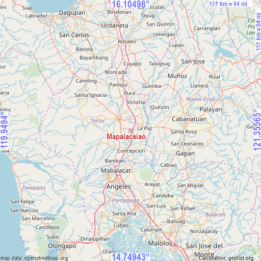
Mapalacsiao GPS coordinates[2]
15° 25' 41.916" North, 120° 39' 9.072" East
| Map corner | latitude | longitude |
|---|---|---|
| Upper-left | 16.10498°, | 119.9494° |
| Center: | 15.42831°, | 120.65252° |
| Lower-right: | 14.74943°, | 121.35565° |
| Map W x H: | 150.7×150.7 km | = 93.6×93.6mi |
| max Lat: | 20.78733° ⇑19% North |
| Mapalacsiao: | 15.42831° |
| min Lat: | ⇓81% South 4.65442° |
| min Long | Mapalacsiao | max Long |
| 117.04868° | 120.65252° | 126.58417° |
| W 13.6%⇐ | ⇒86.4% E |
Elevation
Elevation of Mapalacsiao is 40 m = 131 ft, and this is 47.9 m = 157 ft below average elevation for this country.
| Max E: |
2262 m = 7421 ft | 35.9% |
| Avg. | 87.9 m = 288 ft | |
| Mapalacsiao | 40 m = 131 ft | |
Min E: |
-2 m = -7 ft | 64.1% |
See also: Philippines elevation on elevation.city.
Geographical zone
Mapalacsiao is located in North Torrid zone (between Equator and Tropic of Cancer). Distance of this Northern Tropic circle is 890.5 km =553.3 mi to North.| Distance of | km | miles | from Mapalacsiao |
|---|---|---|---|
| North Pole | 8291.6 | 5152.2 | to North |
| Arctic Circle | 5685.7 | 3532.9 | to North |
| Tropic Cancer | 890.5 | 553.3 | to North |
| Equator | 1715.5 | 1066 | to South |


Nearby cities:
15 places around Mapalacsiao: (largest is in red/bold)
• Amucao
5.4 km =3.4 mi,  42°
42°
• Balingcanaway
6.9 km =4.3 mi,  30°
30°
• Comillas
6.1 km =3.8 mi,  122°
122°
• Dumarais
4.3 km =2.7 mi,  80°
80°
• Mabilog
4 km =2.5 mi,  159°
159°
• Motrico
3.1 km =1.9 mi, 122°
• Murcia
5.4 km =3.4 mi,  240°
240°
• Pando
5.1 km =3.2 mi,  137°
137°
• San Isidro
8 km =5 mi, 78°
• San Manuel
7.1 km =4.4 mi,  11°
11°
• San Miguel
6 km =3.7 mi,  286°
286°
• San Pascual
8.3 km =5.2 mi, 10°
• Santa Rosa
7.8 km =4.8 mi,  209°
209°
• Tarlac City
8.2 km =5.1 mi,  314°
314°
• Tinang
5.8 km =3.6 mi,  179°
179°
Sources, notices
• [Note1] Compared only with cities in Philippines existing in our database
• [Src1] Map data: © OpenStreetMap contributors (CC-BY-SA)
• [Src2] Other city data from geonames.org with taken over terms of usage.
• [Src3] Geographical zone / Annual Mean Temperature by Robert A. Rohde @ Wikipedia
