Cut-cut Primero geodata
Cut-cut Primero (Central Luzon) is a populated place; located in Philippines in Asia/Manila (GMT+8) time zone. With population of 7,143 people, there are 877 cities with bigger population in this country. Compared to other cities in Philippines, 81.5% of cities are located further ↓South; 88.6% of cities are located further →East and 70% of cities have lower elevation than Cut-cut Primero. Note1
Administrative division(s):
- Level 1: Central Luzon
- Level 2: Province of Tarlac
- Level 3: City of Tarlac


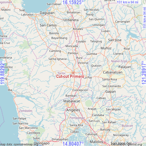
Cut-cut Primero GPS coordinates[2]
15° 28' 57.972" North, 120° 35' 9.744" East
| Map corner | latitude | longitude |
|---|---|---|
| Upper-left | 16.15925°, | 119.88292° |
| Center: | 15.48277°, | 120.58604° |
| Lower-right: | 14.80407°, | 121.28917° |
| Map W x H: | 150.7×150.7 km | = 93.6×93.6mi |
| max Lat: | 20.78733° ⇑18.5% North |
| Cut-cut Primero: | 15.48277° |
| min Lat: | ⇓81.5% South 4.65442° |
| min Long | Cut-cut Primero | max Long |
| 117.04868° | 120.58604° | 126.58417° |
| W 11.4%⇐ | ⇒88.6% E |
Elevation
Elevation of Cut-cut Primero is 52 m = 171 ft, and this is 35.9 m = 118 ft below average elevation for this country.
| Max E: |
2262 m = 7421 ft | 30% |
| Avg. | 87.9 m = 288 ft | |
| Cut-cut Primero | 52 m = 171 ft | |
Min E: |
-2 m = -7 ft | 70% |
See also: Philippines elevation on elevation.city.
Geographical zone
Cut-cut Primero is located in North Torrid zone (between Equator and Tropic of Cancer). Distance of this Northern Tropic circle is 884.4 km =549.5 mi to North.| Distance of | km | miles | from Cut-cut Primero |
|---|---|---|---|
| North Pole | 8285.5 | 5148.4 | to North |
| Arctic Circle | 5679.7 | 3529.2 | to North |
| Tropic Cancer | 884.4 | 549.5 | to North |
| Equator | 1721.5 | 1069.7 | to South |


Nearby cities:
15 places around Cut-cut Primero: (largest is in red/bold)
• Arminia
5.8 km =3.6 mi,  204°
204°
• Bakulong
8.3 km =5.2 mi,  42°
42°
• Balingcanaway
10.7 km =6.6 mi,  90°
90°
• Bularit
10.2 km =6.3 mi,  21°
21°
• Cardona
10 km =6.2 mi,  2°
2°
• Maluid
10.3 km =6.4 mi, 44°
• Mapalacsiao
9.4 km =5.8 mi,  130°
130°
• Murcia
9.1 km =5.7 mi,  164°
164°
• San Juan de Mata
8.4 km =5.2 mi,  314°
314°
• San Manuel
8.6 km =5.3 mi,  84°
84°
• San Miguel
4.5 km =2.8 mi, 161°
• San Pascual
8.9 km =5.5 mi, 76°
• Sinait
6 km =3.7 mi,  359°
359°
• Tariji
5.2 km =3.2 mi, 35°
• Tarlac City
1.3 km =0.8 mi,  102°
102°
Sources, notices
• [Note1] Compared only with cities in Philippines existing in our database
• [Src1] Map data: © OpenStreetMap contributors (CC-BY-SA)
• [Src2] Other city data from geonames.org with taken over terms of usage.
• [Src3] Geographical zone / Annual Mean Temperature by Robert A. Rohde @ Wikipedia
