Ambulong geodata
Ambulong (Western Visayas) is a populated place; located in Philippines in Asia/Manila (GMT+8) time zone. With population of 2,195 people, there are 3897 cities with bigger population in this country. Compared to other cities in Philippines, 50.5% of cities are located further ↑North; 54.9% of cities are located further →East and 85.4% of cities have higher elevation than Ambulong. Note1


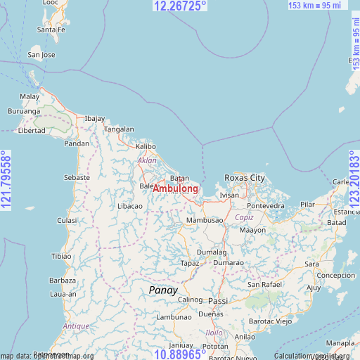
Ambulong GPS coordinates[2]
11° 34' 45.48" North, 122° 29' 55.32" East
| Map corner | latitude | longitude |
|---|---|---|
| Upper-left | 12.26725°, | 121.79558° |
| Center: | 11.5793°, | 122.4987° |
| Lower-right: | 10.88965°, | 123.20183° |
| Map W x H: | 153.2×153.2 km | = 95.2×95.2mi |
| max Lat: | 20.78733° ⇑50.5% North |
| Ambulong: | 11.5793° |
| min Lat: | ⇓49.5% South 4.65442° |
| min Long | Ambulong | max Long |
| 117.04868° | 122.4987° | 126.58417° |
| W 45.1%⇐ | ⇒54.9% E |
Elevation
Elevation of Ambulong is 8 m = 26 ft, and this is 79.9 m = 262 ft below average elevation for this country.
| Max E: |
2262 m = 7421 ft | 85.4% |
| Avg. | 87.9 m = 288 ft | |
| Ambulong | 8 m = 26 ft | |
Min E: |
-2 m = -7 ft | 14.6% |
See also: Philippines elevation on elevation.city.
Geographical zone
Ambulong is located in North Torrid zone (between Equator and Tropic of Cancer). Distance of Equator is 1287.5 km =800 mi to South.| Distance of | km | miles | from Ambulong |
|---|---|---|---|
| North Pole | 8719.6 | 5418.1 | to North |
| Arctic Circle | 6113.7 | 3798.9 | to North |
| Tropic Cancer | 1318.4 | 819.2 | to North |
| Equator | 1287.5 | 800 | to South |


Nearby cities:
15 places around Ambulong: (largest is in red/bold)
• Altavas
4.8 km =3 mi,  195°
195°
• Aranas Sur
12 km =7.5 mi,  261°
261°
• Batan
0.7 km =0.4 mi,  346°
346°
• Bilao
12.1 km =7.5 mi,  146°
146°
• Calizo
12.3 km =7.6 mi,  271°
271°
• Cawayan
6.2 km =3.9 mi,  323°
323°
• Cortez
12.3 km =7.6 mi,  243°
243°
• Damayan
11.2 km =7 mi, 148°
• Lalab
7.7 km =4.8 mi, 266°
• Lonoy
9.5 km =5.9 mi,  141°
141°
• Lupo
8.3 km =5.2 mi,  194°
194°
• Manup
5.3 km =3.3 mi,  180°
180°
• New Washington
10.8 km =6.7 mi, 317°
• Ochanado
4.2 km =2.6 mi,  336°
336°
• Odiong
6 km =3.7 mi,  215°
215°
Sources, notices
• [Note1] Compared only with cities in Philippines existing in our database
• [Src1] Map data: © OpenStreetMap contributors (CC-BY-SA)
• [Src2] Other city data from geonames.org with taken over terms of usage.
• [Src3] Geographical zone / Annual Mean Temperature by Robert A. Rohde @ Wikipedia
