Ochanado geodata
Ochanado (Western Visayas) is a populated place; located in Philippines in Asia/Manila (GMT+8) time zone. With population of 2,615 people, there are 3082 cities with bigger population in this country. Compared to other cities in Philippines, 50.2% of cities are located further ↑North; 55.2% of cities are located further →East and 76.6% of cities have higher elevation than Ochanado. Note1
Administrative division(s):
- Level 1: Western Visayas
- Level 2: Province of Aklan
- Level 3: New Washington


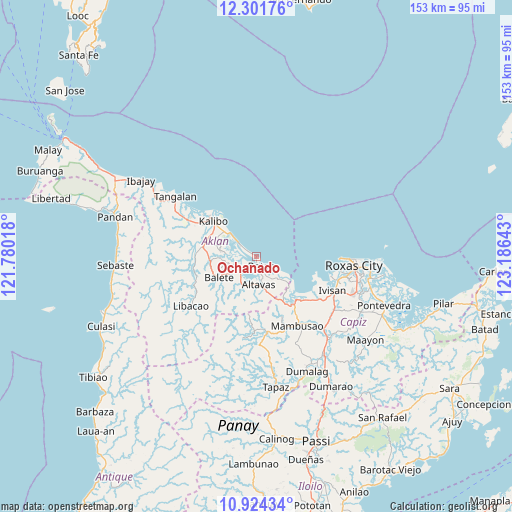
Ochanado GPS coordinates[2]
11° 36' 50.04" North, 122° 28' 59.88" East
| Map corner | latitude | longitude |
|---|---|---|
| Upper-left | 12.30176°, | 121.78018° |
| Center: | 11.6139°, | 122.4833° |
| Lower-right: | 10.92434°, | 123.18643° |
| Map W x H: | 153.2×153.2 km | = 95.2×95.2mi |
| max Lat: | 20.78733° ⇑50.2% North |
| Ochanado: | 11.6139° |
| min Lat: | ⇓49.8% South 4.65442° |
| min Long | Ochanado | max Long |
| 117.04868° | 122.4833° | 126.58417° |
| W 44.8%⇐ | ⇒55.2% E |
Elevation
Elevation of Ochanado is 10 m = 33 ft, and this is 77.9 m = 256 ft below average elevation for this country.
| Max E: |
2262 m = 7421 ft | 76.6% |
| Avg. | 87.9 m = 288 ft | |
| Ochanado | 10 m = 33 ft | |
Min E: |
-2 m = -7 ft | 23.4% |
See also: Philippines elevation on elevation.city.
Geographical zone
Ochanado is located in North Torrid zone (between Equator and Tropic of Cancer). Distance of Equator is 1291.3 km =802.4 mi to South.| Distance of | km | miles | from Ochanado |
|---|---|---|---|
| North Pole | 8715.7 | 5415.7 | to North |
| Arctic Circle | 6109.8 | 3796.5 | to North |
| Tropic Cancer | 1314.6 | 816.9 | to North |
| Equator | 1291.3 | 802.4 | to South |


Nearby cities:
15 places around Ochanado: (largest is in red/bold)
• Altavas
8.4 km =5.2 mi,  177°
177°
• Ambulong
4.2 km =2.6 mi,  156°
156°
• Aranas Sur
11.6 km =7.2 mi,  241°
241°
• Batan
3.5 km =2.2 mi,  154°
154°
• Brgy. Mabilo, New Washington
10.9 km =6.8 mi,  310°
310°
• Calizo
11.2 km =7 mi,  251°
251°
• Cawayan
2.3 km =1.4 mi,  298°
298°
• Guinoaliuan
11.7 km =7.3 mi,  294°
294°
• Lalab
7.4 km =4.6 mi,  234°
234°
• Lupo
11.8 km =7.3 mi, 182°
• Manup
9.3 km =5.8 mi,  170°
170°
• New Washington
6.9 km =4.3 mi, 306°
• Odiong
8.9 km =5.5 mi,  191°
191°
• Tambac
10.1 km =6.3 mi, 308°
• Tugas
11 km =6.8 mi,  269°
269°
Sources, notices
• [Note1] Compared only with cities in Philippines existing in our database
• [Src1] Map data: © OpenStreetMap contributors (CC-BY-SA)
• [Src2] Other city data from geonames.org with taken over terms of usage.
• [Src3] Geographical zone / Annual Mean Temperature by Robert A. Rohde @ Wikipedia
