Alanib geodata
Alanib (Northern Mindanao) is a populated place; located in Philippines in Asia/Manila (GMT+8) time zone. With population of 4,207 people, there are 1626 cities with bigger population in this country. Compared to other cities in Philippines, 82.4% of cities are located further ↑North; 87.4% of cities are located further ←West and 98.5% of cities have lower elevation than Alanib. Note1
Administrative division(s):
- Level 1: Northern Mindanao
- Level 2: Province of Bukidnon
- Level 3: Lantapan


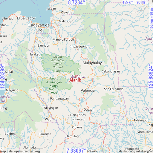
Alanib GPS coordinates[2]
8° 1' 40.008" North, 124° 59' 9.996" East
| Map corner | latitude | longitude |
|---|---|---|
| Upper-left | 8.7234°, | 124.28299° |
| Center: | 8.02778°, | 124.98611° |
| Lower-right: | 7.33097°, | 125.68924° |
| Map W x H: | 154.8×154.8 km | = 96.2×96.2mi |
| max Lat: | 20.78733° ⇑82.4% North |
| Alanib: | 8.02778° |
| min Lat: | ⇓17.6% South 4.65442° |
| min Long | Alanib | max Long |
| 117.04868° | 124.98611° | 126.58417° |
| W 87.4%⇐ | ⇒12.6% E |
Elevation
Elevation of Alanib is 820 m = 2690 ft, and this is 732.1 m = 2402 ft above average elevation for this country.
| Max E: |
2262 m = 7421 ft | 1.5% |
| Alanib | 820 m 2690 ft | |
| Avg. | 87.9 m = 288 ft | |
Min E: |
-2 m = -7 ft | 98.5% |
See also: Philippines elevation on elevation.city.
Geographical zone
Alanib is located in North Torrid zone (between Equator and Tropic of Cancer). Distance of Equator is 892.6 km =554.6 mi to South.| Distance of | km | miles | from Alanib |
|---|---|---|---|
| North Pole | 9114.5 | 5663.5 | to North |
| Arctic Circle | 6508.6 | 4044.3 | to North |
| Tropic Cancer | 1713.3 | 1064.6 | to North |
| Equator | 892.6 | 554.6 | to South |


Nearby cities:
15 places around Alanib: (largest is in red/bold)
• Aglayan
16.6 km =10.3 mi,  79°
79°
• Balila
4.1 km =2.5 mi,  133°
133°
• Bantuanon
9.4 km =5.8 mi,  98°
98°
• Basak
13.7 km =8.5 mi,  276°
276°
• Bugcaon
14.1 km =8.8 mi, 81°
• Cabangahan
16.7 km =10.4 mi,  91°
91°
• Casisang
19.6 km =12.2 mi,  51°
51°
• Kibangay
10.5 km =6.5 mi, 283°
• Laguitas
17.3 km =10.7 mi,  66°
66°
• Lantapan
5.7 km =3.5 mi, 126°
• Linabo
18.8 km =11.7 mi, 81°
• Lurugan
2.5 km =1.6 mi,  240°
240°
• Mailag
17.9 km =11.1 mi,  110°
110°
• NIA Valencia
18 km =11.2 mi,  138°
138°
• San Carlos
12.6 km =7.8 mi, 126°
Sources, notices
• [Note1] Compared only with cities in Philippines existing in our database
• [Src1] Map data: © OpenStreetMap contributors (CC-BY-SA)
• [Src2] Other city data from geonames.org with taken over terms of usage.
• [Src3] Geographical zone / Annual Mean Temperature by Robert A. Rohde @ Wikipedia
