Basak geodata
Basak (Northern Mindanao) is a populated place; located in Philippines in Asia/Manila (GMT+8) time zone. With population of 2,457 people, there are 3368 cities with bigger population in this country. Compared to other cities in Philippines, 82.3% of cities are located further ↑North; 85.6% of cities are located further ←West and 99.2% of cities have lower elevation than Basak. Note1
Administrative division(s):
- Level 1: Northern Mindanao
- Level 2: Province of Bukidnon
- Level 3: Lantapan


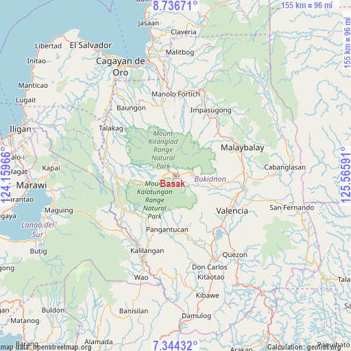
Basak GPS coordinates[2]
8° 2' 27.996" North, 124° 51' 46.008" East
| Map corner | latitude | longitude |
|---|---|---|
| Upper-left | 8.73671°, | 124.15966° |
| Center: | 8.04111°, | 124.86278° |
| Lower-right: | 7.34432°, | 125.56591° |
| Map W x H: | 154.8×154.8 km | = 96.2×96.2mi |
| max Lat: | 20.78733° ⇑82.3% North |
| Basak: | 8.04111° |
| min Lat: | ⇓17.7% South 4.65442° |
| min Long | Basak | max Long |
| 117.04868° | 124.86278° | 126.58417° |
| W 85.6%⇐ | ⇒14.4% E |
Elevation
Elevation of Basak is 1139 m = 3737 ft, and this is 1051.1 m = 3448 ft above average elevation for this country.
| Max E: |
2262 m = 7421 ft | 0.8% |
| Basak | 1139 m 3737 ft | |
| Avg. | 87.9 m = 288 ft | |
Min E: |
-2 m = -7 ft | 99.2% |
See also: Philippines elevation on elevation.city.
Geographical zone
Basak is located in North Torrid zone (between Equator and Tropic of Cancer). Distance of Equator is 894.1 km =555.6 mi to South.| Distance of | km | miles | from Basak |
|---|---|---|---|
| North Pole | 9113 | 5662.6 | to North |
| Arctic Circle | 6507.1 | 4043.3 | to North |
| Tropic Cancer | 1711.8 | 1063.7 | to North |
| Equator | 894.1 | 555.6 | to South |


Nearby cities:
15 places around Basak: (largest is in red/bold)
• Adtugan
25.5 km =15.8 mi,  182°
182°
• Alanib
13.7 km =8.5 mi,  96°
96°
• Balila
17.1 km =10.6 mi, 104°
• Bantuanon
23.1 km =14.4 mi, 97°
• Dalwangan
26.4 km =16.4 mi,  47°
47°
• Kalugmanan
26.3 km =16.3 mi,  359°
359°
• Kibangay
3.5 km =2.2 mi,  73°
73°
• La Roxas
19.9 km =12.4 mi,  172°
172°
• Lantapan
18.8 km =11.7 mi, 104°
• Lurugan
11.8 km =7.3 mi, 103°
• Pangantocan
22.3 km =13.9 mi,  194°
194°
• Pontian
27 km =16.8 mi,  8°
8°
• San Carlos
25.3 km =15.7 mi,  110°
110°
• San Miguel
12.1 km =7.5 mi,  264°
264°
• Ticala-an
26.6 km =16.5 mi,  268°
268°
Sources, notices
• [Note1] Compared only with cities in Philippines existing in our database
• [Src1] Map data: © OpenStreetMap contributors (CC-BY-SA)
• [Src2] Other city data from geonames.org with taken over terms of usage.
• [Src3] Geographical zone / Annual Mean Temperature by Robert A. Rohde @ Wikipedia
