Makir geodata
Makir (Autonomous Region in Muslim Mindanao) is a populated place; located in Philippines in Asia/Manila (GMT+8) time zone. With population of 2,371 people, there are 3516 cities with bigger population in this country. Compared to other cities in Philippines, 91.4% of cities are located further ↑North; 75.6% of cities are located further ←West and 60.3% of cities have lower elevation than Makir. Note1
Administrative division(s):
- Level 1: Autonomous Region in Muslim Mindanao
- Level 2: Province of Maguindanao
- Level 3: Datu Odin Sinsuat (Dinaig)


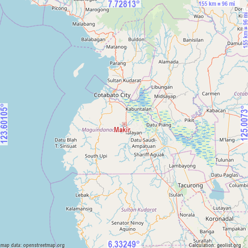
Makir GPS coordinates[2]
7° 1' 50.988" North, 124° 18' 15.012" East
| Map corner | latitude | longitude |
|---|---|---|
| Upper-left | 7.72813°, | 123.60105° |
| Center: | 7.03083°, | 124.30417° |
| Lower-right: | 6.33249°, | 125.0073° |
| Map W x H: | 155.2×155.2 km | = 96.4×96.4mi |
| max Lat: | 20.78733° ⇑91.4% North |
| Makir: | 7.03083° |
| min Lat: | ⇓8.6% South 4.65442° |
| min Long | Makir | max Long |
| 117.04868° | 124.30417° | 126.58417° |
| W 75.6%⇐ | ⇒24.4% E |
Elevation
Elevation of Makir is 34 m = 112 ft, and this is 53.9 m = 177 ft below average elevation for this country.
| Max E: |
2262 m = 7421 ft | 39.7% |
| Avg. | 87.9 m = 288 ft | |
| Makir | 34 m = 112 ft | |
Min E: |
-2 m = -7 ft | 60.3% |
See also: Philippines elevation on elevation.city.
Geographical zone
Makir is located in North Torrid zone (between Equator and Tropic of Cancer). Distance of Equator is 781.8 km =485.8 mi to South.| Distance of | km | miles | from Makir |
|---|---|---|---|
| North Pole | 9225.3 | 5732.3 | to North |
| Arctic Circle | 6619.4 | 4113.1 | to North |
| Tropic Cancer | 1824.2 | 1133.5 | to North |
| Equator | 781.8 | 485.8 | to South |


Nearby cities:
15 places around Makir: (largest is in red/bold)
• Awang
16.4 km =10.2 mi,  326°
326°
• Bagan
17.4 km =10.8 mi,  132°
132°
• Blinsung
13.7 km =8.5 mi,  264°
264°
• Bongued
14.2 km =8.8 mi,  47°
47°
• Dado
17.3 km =10.7 mi,  82°
82°
• Dadus
3.5 km =2.2 mi,  33°
33°
• Dalican
12.8 km =8 mi,  124°
124°
• Dinaig
1.3 km =0.8 mi, 116°
• Katidtuan
17.6 km =10.9 mi,  3°
3°
• Kitapak
15.9 km =9.9 mi, 122°
• Labuñgan
11.1 km =6.9 mi,  316°
316°
• Pagaluñgan
14.9 km =9.3 mi, 34°
• Talayan
10.2 km =6.3 mi, 123°
• Taviran
10.4 km =6.5 mi,  9°
9°
• Upi
15.2 km =9.4 mi,  267°
267°
Sources, notices
• [Note1] Compared only with cities in Philippines existing in our database
• [Src1] Map data: © OpenStreetMap contributors (CC-BY-SA)
• [Src2] Other city data from geonames.org with taken over terms of usage.
• [Src3] Geographical zone / Annual Mean Temperature by Robert A. Rohde @ Wikipedia
