Upi geodata
Upi (Autonomous Region in Muslim Mindanao) is a populated place; located in Philippines in Asia/Manila (GMT+8) time zone. With population of 9,358 people, there are 659 cities with bigger population in this country. Compared to other cities in Philippines, 91.5% of cities are located further ↑North; 73.6% of cities are located further ←West and 95.4% of cities have lower elevation than Upi. Note1
Administrative division(s):
- Level 1: Autonomous Region in Muslim Mindanao
- Level 2: Province of Maguindanao
- Level 3: Upi


Upi GPS coordinates[2]
7° 1' 32.988" North, 124° 10' 0.012" East
| Map corner | latitude | longitude |
|---|---|---|
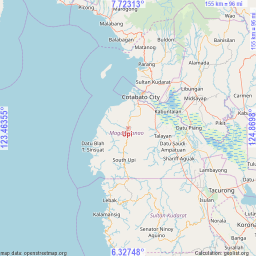
| Upper-left | 7.72313°, | 123.46355° |
| Center: | 7.02583°, | 124.16667° |
| Lower-right: | 6.32748°, | 124.8698° |
| Map W x H: | 155.2×155.2 km | = 96.4×96.4mi |
| max Lat: | 20.78733° ⇑91.5% North |
| Upi: | 7.02583° |
| min Lat: | ⇓8.5% South 4.65442° |
| min Long | Upi | max Long |
| 117.04868° | 124.16667° | 126.58417° |
| W 73.6%⇐ | ⇒26.4% E |
Elevation
Elevation of Upi is 447 m = 1467 ft, and this is 359.1 m = 1178 ft above average elevation for this country.
| Max E: |
2262 m = 7421 ft | 4.6% |
| Upi | 447 m 1467 ft | |
| Avg. | 87.9 m = 288 ft | |
Min E: |
-2 m = -7 ft | 95.4% |
See also: Philippines elevation on elevation.city.
Geographical zone
Upi is located in North Torrid zone (between Equator and Tropic of Cancer). Distance of Equator is 781.2 km =485.4 mi to South.| Distance of | km | miles | from Upi |
|---|---|---|---|
| North Pole | 9225.9 | 5732.7 | to North |
| Arctic Circle | 6620 | 4113.5 | to North |
| Tropic Cancer | 1824.7 | 1133.8 | to North |
| Equator | 781.2 | 485.4 | to South |


Nearby cities:
15 places around Upi: (largest is in red/bold)
• Awang
15.4 km =9.6 mi,  23°
23°
• Blinsung
1.8 km =1.1 mi,  119°
119°
• Cotabato
23.7 km =14.7 mi, 21°
• Dadus
17.5 km =10.9 mi,  78°
78°
• Dinaig
16.4 km =10.2 mi,  90°
90°
• Katidtuan
24.4 km =15.2 mi,  42°
42°
• Labuñgan
11.4 km =7.1 mi, 41°
• Makir
15.2 km =9.4 mi, 87°
• Rimpeso
7.3 km =4.5 mi,  268°
268°
• Salimbao
23.9 km =14.9 mi, 23°
• South Upi
21.5 km =13.4 mi,  184°
184°
• Sultan Kudarat
24.7 km =15.3 mi, 23°
• Talayan
24.3 km =15.1 mi,  101°
101°
• Tamontaka
18.4 km =11.4 mi, 20°
• Taviran
20.1 km =12.5 mi,  57°
57°
Sources, notices
• [Note1] Compared only with cities in Philippines existing in our database
• [Src1] Map data: © OpenStreetMap contributors (CC-BY-SA)
• [Src2] Other city data from geonames.org with taken over terms of usage.
• [Src3] Geographical zone / Annual Mean Temperature by Robert A. Rohde @ Wikipedia
