Bagan geodata
Bagan (Autonomous Region in Muslim Mindanao) is a populated place; located in Philippines in Asia/Manila (GMT+8) time zone. With population of 2,230 people, there are 3825 cities with bigger population in this country. Compared to other cities in Philippines, 92.4% of cities are located further ↑North; 77.8% of cities are located further ←West and 50.3% of cities have higher elevation than Bagan. Note1
Administrative division(s):
- Level 1: Autonomous Region in Muslim Mindanao
- Level 2: Province of Maguindanao
- Level 3: Datu Saudi-Ampatuan


Bagan GPS coordinates[2]
6° 55' 32.016" North, 124° 25' 13.008" East
| Map corner | latitude | longitude |
|---|---|---|
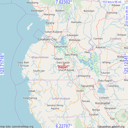
| Upper-left | 7.62302°, | 123.71716° |
| Center: | 6.92556°, | 124.42028° |
| Lower-right: | 6.22707°, | 125.12341° |
| Map W x H: | 155.2×155.2 km | = 96.4×96.4mi |
| max Lat: | 20.78733° ⇑92.4% North |
| Bagan: | 6.92556° |
| min Lat: | ⇓7.6% South 4.65442° |
| min Long | Bagan | max Long |
| 117.04868° | 124.42028° | 126.58417° |
| W 77.8%⇐ | ⇒22.2% E |
Elevation
Elevation of Bagan is 23 m = 75 ft, and this is 64.9 m = 213 ft below average elevation for this country.
| Max E: |
2262 m = 7421 ft | 50.3% |
| Avg. | 87.9 m = 288 ft | |
| Bagan | 23 m = 75 ft | |
Min E: |
-2 m = -7 ft | 49.7% |
See also: Philippines elevation on elevation.city.
Geographical zone
Bagan is located in North Torrid zone (between Equator and Tropic of Cancer). Distance of Equator is 770.1 km =478.5 mi to South.| Distance of | km | miles | from Bagan |
|---|---|---|---|
| North Pole | 9237 | 5739.6 | to North |
| Arctic Circle | 6631.1 | 4120.4 | to North |
| Tropic Cancer | 1835.9 | 1140.8 | to North |
| Equator | 770.1 | 478.5 | to South |


Nearby cities:
15 places around Bagan: (largest is in red/bold)
• Ampatuan
8.3 km =5.2 mi,  141°
141°
• Dado
14.5 km =9 mi,  17°
17°
• Dalican
5.1 km =3.2 mi,  333°
333°
• Damabalas
14.4 km =8.9 mi,  45°
45°
• Damatulan
14.4 km =8.9 mi,  28°
28°
• Datu Piang
14.6 km =9.1 mi,  38°
38°
• Dinaig
16.1 km =10 mi,  313°
313°
• Kauran
15.6 km =9.7 mi,  159°
159°
• Kitango
3.4 km =2.1 mi, 42°
• Kitapak
3.1 km =1.9 mi,  10°
10°
• Maganoy
7.2 km =4.5 mi, 160°
• Pagatin
8 km =5 mi, 48°
• Satan
7.1 km =4.4 mi,  190°
190°
• Talayan
7.4 km =4.6 mi, 325°
• Tapikan
13.5 km =8.4 mi,  232°
232°
Sources, notices
• [Note1] Compared only with cities in Philippines existing in our database
• [Src1] Map data: © OpenStreetMap contributors (CC-BY-SA)
• [Src2] Other city data from geonames.org with taken over terms of usage.
• [Src3] Geographical zone / Annual Mean Temperature by Robert A. Rohde @ Wikipedia
