Thatta geodata
Thatta (Sindh) is a seat of a second-order administrative division; located in Pakistan in Asia/Karachi (GMT+5) time zone. With population of 44,302 people, there are 145 cities with bigger population in this country. Compared to other cities in Pakistan, 97.5% of cities are located further ↑North; 89.2% of cities are located further →East and 94.6% of cities have higher elevation than Thatta. Note1


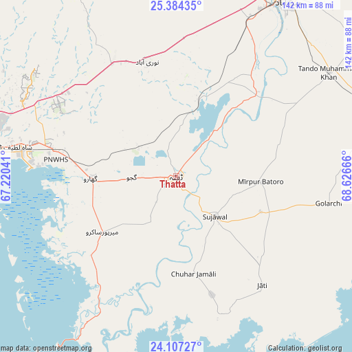
Thatta GPS coordinates[2]
24° 44' 50.82" North, 67° 55' 24.708" East
| Map corner | latitude | longitude |
|---|---|---|
| Upper-left | 25.38435°, | 67.22041° |
| Center: | 24.74745°, | 67.92353° |
| Lower-right: | 24.10727°, | 68.62666° |
| Map W x H: | 142×142 km | = 88.2×88.2mi |
| max Lat: | 36.32162° ⇑97.5% North |
| Thatta: | 24.74745° |
| min Lat: | ⇓2.5% South 24.14422° |
| min Long | Thatta | max Long |
| 61.74573° | 67.92353° | 75.63372° |
| W 10.8%⇐ | ⇒89.2% E |
Elevation
Elevation of Thatta is 17 m = 56 ft, and this is 328 m = 1076 ft below average elevation for this country.
| Max E: |
2732 m = 8963 ft | 94.6% |
| Avg. | 345 m = 1132 ft | |
| Thatta | 17 m = 56 ft | |
Min E: |
3 m = 10 ft | 5.4% |
See also: Thatta elevation on elevation.city.
Geographical zone
Thatta is located in North temperate zone (between Tropic of Cancer and the Arctic Circle). Distance of this Northern Tropic circle is 145.7 km =90.5 mi to South.| Distance of | km | miles | from Thatta |
|---|---|---|---|
| North Pole | 7255.4 | 4508.3 | to North |
| Arctic Circle | 4649.5 | 2889.1 | to North |
| Tropic Cancer | 145.7 | 90.5 | to South |
| Equator | 2751.7 | 1709.8 | to South |


Nearby cities:
15 places around Thatta: (largest is in red/bold)
• Bulri
43.4 km =27 mi,  72°
72°
• Chuhar Jamali
39.9 km =24.8 mi,  169°
169°
• Daromehar
26.4 km =16.4 mi,  78°
78°
• Gharo
34.2 km =21.3 mi,  268°
268°
• Jamshoro
84.6 km =52.6 mi,  25°
25°
• Jati
55.8 km =34.7 mi,  141°
141°
• Kario Ghanwar
69.1 km =42.9 mi, 84°
• Keti Bandar
82.4 km =51.2 mi,  215°
215°
• Kotri
78.9 km =49 mi, 29°
• Malir Cantonment
75.6 km =47 mi,  286°
286°
• Matli
80.8 km =50.2 mi, 66°
• Mirpur Bhtoro
34.1 km =21.2 mi,  93°
93°
• Mirpur Sakro
37.3 km =23.2 mi,  233°
233°
• Nooriabad
49.2 km =30.6 mi,  345°
345°
• Tando Muhammad Khan
74.7 km =46.4 mi,  55°
55°
Sources, notices
• [Note1] Compared only with cities in Pakistan existing in our database
• [Src1] Map data: © OpenStreetMap contributors (CC-BY-SA)
• [Src2] Other city data from geonames.org with taken over terms of usage.
• [Src3] Geographical zone / Annual Mean Temperature by Robert A. Rohde @ Wikipedia
