Malir Cantonment geodata
Malir Cantonment (Sindh) is a section of populated place; located in Pakistan in Asia/Karachi (GMT+5) time zone. With population of 300,000 people, there are 24 cities with bigger population in this country. Compared to other cities in Pakistan, 95.7% of cities are located further ↑North; 94.8% of cities are located further →East and 81% of cities have higher elevation than Malir Cantonment. Note1


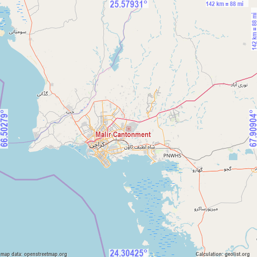
Malir Cantonment GPS coordinates[2]
24° 56' 36.348" North, 67° 12' 21.276" East
| Map corner | latitude | longitude |
|---|---|---|
| Upper-left | 25.57931°, | 66.50279° |
| Center: | 24.94343°, | 67.20591° |
| Lower-right: | 24.30425°, | 67.90904° |
| Map W x H: | 141.8×141.8 km | = 88.1×88.1mi |
| max Lat: | 36.32162° ⇑95.7% North |
| Malir Cantonment: | 24.94343° |
| min Lat: | ⇓4.3% South 24.14422° |
| min Long | Malir Cantonmen | max Long |
| 61.74573° | 67.20591° | 75.63372° |
| W 5.2%⇐ | ⇒94.8% E |
Elevation
Elevation of Malir Cantonment is 52 m = 171 ft, and this is 293 m = 961 ft below average elevation for this country.
| Max E: |
2732 m = 8963 ft | 81% |
| Avg. | 345 m = 1132 ft | |
| Malir Cantonment | 52 m = 171 ft | |
Min E: |
3 m = 10 ft | 19% |
See also: Malir Cantonment elevation on elevation.city.
Geographical zone
Malir Cantonment is located in North temperate zone (between Tropic of Cancer and the Arctic Circle). Distance of this Northern Tropic circle is 167.5 km =104.1 mi to South.| Distance of | km | miles | from Malir Cantonment |
|---|---|---|---|
| North Pole | 7233.6 | 4494.7 | to North |
| Arctic Circle | 4627.7 | 2875.5 | to North |
| Tropic Cancer | 167.5 | 104.1 | to South |
| Equator | 2773.4 | 1723.3 | to South |


Nearby cities:
15 places around Malir Cantonment: (largest is in red/bold)
• Bulri
114 km =70.8 mi,  94°
94°
• Chuhar Jamali
100.3 km =62.3 mi,  127°
127°
• Daromehar
99.6 km =61.9 mi,  99°
99°
• Gadani
51.6 km =32.1 mi,  292°
292°
• Gharo
44.4 km =27.6 mi,  120°
120°
• Jamshoro
121.2 km =75.3 mi,  63°
63°
• Jati
125.6 km =78 mi, 121°
• Karachi
21.8 km =13.5 mi,  245°
245°
• Keti Bandar
92.3 km =57.4 mi,  164°
164°
• Kotri
120.5 km =74.9 mi,  67°
67°
• Mirpur Bhtoro
109 km =67.7 mi, 102°
• Mirpur Sakro
61.3 km =38.1 mi,  135°
135°
• Nooriabad
65.1 km =40.5 mi, 66°
• Thatta
75.6 km =47 mi,  106°
106°
• Uthal
112.5 km =69.9 mi,  328°
328°
Sources, notices
• [Note1] Compared only with cities in Pakistan existing in our database
• [Src1] Map data: © OpenStreetMap contributors (CC-BY-SA)
• [Src2] Other city data from geonames.org with taken over terms of usage.
• [Src3] Geographical zone / Annual Mean Temperature by Robert A. Rohde @ Wikipedia
