Żerniki Wrocławskie geodata
Żerniki Wrocławskie (Lower Silesia) is a populated place; located in Poland in Europe/Warsaw (GMT+2) time zone. With population of 1,427 people, there are 1930 cities with bigger population in this country. Compared to other cities in Poland, 54.4% of cities are located further ↑North; 83.8% of cities are located further →East and 65.6% of cities have higher elevation than Żerniki Wrocławskie. Note1


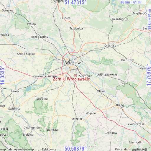
Żerniki Wrocławskie GPS coordinates[2]
51° 1' 59.088" North, 17° 3' 23.832" East
| Map corner | latitude | longitude |
|---|---|---|
| Upper-left | 51.47315°, | 16.3535° |
| Center: | 51.03308°, | 17.05662° |
| Lower-right: | 50.58879°, | 17.75975° |
| Map W x H: | 98.3×98.3 km | = 61.1×61.1mi |
| max Lat: | 54.83135° ⇑54.4% North |
| Żerniki Wrocławskie: | 51.03308° |
| min Lat: | ⇓45.6% South 49.21328° |
| min Long | Żerniki Wrocł | max Long |
| 14.20249° | 17.05662° | 24.03723° |
| W 16.2%⇐ | ⇒83.8% E |
Elevation
Elevation of Żerniki Wrocławskie is 131 m = 430 ft, and this is 60.4 m = 198 ft below average elevation for this country.
| Max E: |
974 m = 3196 ft | 65.6% |
| Avg. | 191.4 m = 628 ft | |
| Żerniki Wrocławskie | 131 m = 430 ft | |
Min E: |
-3 m = -10 ft | 34.4% |
See also: Poland elevation on elevation.city.
Geographical zone
Żerniki Wrocławskie is located in North temperate zone (between Tropic of Cancer and the Arctic Circle). Distance of this North polar circle is 1726.8 km =1073 mi to North.| Distance of | km | miles | from Żerniki Wrocławskie |
|---|---|---|---|
| North Pole | 4332.7 | 2692.2 | to North |
| Arctic Circle | 1726.8 | 1073 | to North |
| Tropic Cancer | 3068.4 | 1906.6 | to South |
| Equator | 5674.3 | 3525.8 | to South |


Nearby cities:
15 places around Żerniki Wrocławskie: (largest is in red/bold)
• Bielany Wrocławskie
6.2 km =3.9 mi,  273°
273°
• Domasław
7.4 km =4.6 mi,  251°
251°
• Krzyki
6 km =3.7 mi,  314°
314°
• Księże Małe-Księże Wielkie
5 km =3.1 mi,  26°
26°
• Osiedle Henrykowskie
6.3 km =3.9 mi,  357°
357°
• Partynice
4.9 km =3 mi,  322°
322°
• Powstańców Śląskich Wschód
6.9 km =4.3 mi,  341°
341°
• Radwanice
4.4 km =2.7 mi,  57°
57°
• Rakowiec-Opatowice
7.1 km =4.4 mi, 27°
• Rejon ulicy Borowskiej-Południe
5.3 km =3.3 mi, 336°
• Rejon ulicy Saperów
7.1 km =4.4 mi,  326°
326°
• Siechnice
6.4 km =4 mi,  89°
89°
• Wojszyce
2.9 km =1.8 mi, 344°
• Święta Katarzyna
4.1 km =2.5 mi,  101°
101°
• Żórawina
6 km =3.7 mi,  193°
193°
Sources, notices
• [Note1] Compared only with cities in Poland existing in our database
• [Src1] Map data: © OpenStreetMap contributors (CC-BY-SA)
• [Src2] Other city data from geonames.org with taken over terms of usage.
• [Src3] Geographical zone / Annual Mean Temperature by Robert A. Rohde @ Wikipedia
