Księże Małe-Księże Wielkie geodata
Księże Małe-Księże Wielkie (Lower Silesia) is a section of populated place; located in Poland in Europe/Warsaw (GMT+2) time zone. With population of 5,541 people, there are 636 cities with bigger population in this country. Compared to other cities in Poland, 53.5% of cities are located further ↑North; 83.4% of cities are located further →East and 71.6% of cities have higher elevation than Księże Małe-Księże Wielkie. Note1
Administrative division(s):
- Level 1: Lower Silesia
- Level 2: Wrocław
- Level 3: Wrocław
- Level 4: Księże
Current local time in Księże Małe-Księże Wielkie:
04:04 AM, SaturdayDifference from your time zone: hours


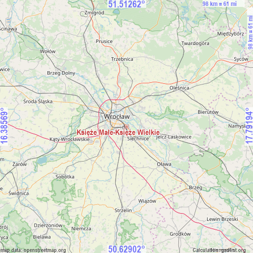
Księże Małe-Księże Wielkie GPS coordinates[2]
51° 4' 22.548" North, 17° 5' 19.716" East
| Map corner | latitude | longitude |
|---|---|---|
| Upper-left | 51.51262°, | 16.38569° |
| Center: | 51.07293°, | 17.08881° |
| Lower-right: | 50.62902°, | 17.79194° |
| Map W x H: | 98.2×98.2 km | = 61×61mi |
| max Lat: | 54.83135° ⇑53.5% North |
| Księże Małe-Księże Wielkie: | 51.07293° |
| min Lat: | ⇓46.5% South 49.21328° |
| min Long | Księże Małe- | max Long |
| 14.20249° | 17.08881° | 24.03723° |
| W 16.6%⇐ | ⇒83.4% E |
Elevation
Elevation of Księże Małe-Księże Wielkie is 118 m = 387 ft, and this is 73.4 m = 241 ft below average elevation for this country.
| Max E: |
974 m = 3196 ft | 71.6% |
| Avg. | 191.4 m = 628 ft | |
| Księże Małe-Księże Wielkie | 118 m = 387 ft | |
Min E: |
-3 m = -10 ft | 28.4% |
See also: Poland elevation on elevation.city.
Geographical zone
Księże Małe-Księże Wielkie is located in North temperate zone (between Tropic of Cancer and the Arctic Circle). Distance of this North polar circle is 1722.4 km =1070.2 mi to North.| Distance of | km | miles | from Księże Małe-Księże Wielkie |
|---|---|---|---|
| North Pole | 4328.3 | 2689.5 | to North |
| Arctic Circle | 1722.4 | 1070.2 | to North |
| Tropic Cancer | 3072.9 | 1909.4 | to South |
| Equator | 5678.8 | 3528.6 | to South |


Nearby cities:
15 places around Księże Małe-Księże Wielkie: (largest is in red/bold)
• Biskupin
3.3 km =2.1 mi,  19°
19°
• Dąbie
3.7 km =2.3 mi,  351°
351°
• Osiedle Henrykowskie
3.1 km =1.9 mi,  307°
307°
• Powstańców Śląskich Wschód
4.9 km =3 mi,  294°
294°
• Radwanice
2.5 km =1.6 mi,  145°
145°
• Rakowiec-Opatowice
2.1 km =1.3 mi,  28°
28°
• Rejon placu Grunwaldzkiego
5.2 km =3.2 mi,  338°
338°
• Rejon ulicy Borowskiej-Południe
4.4 km =2.7 mi,  275°
275°
• Rejon ulicy Traugutta
4.3 km =2.7 mi,  319°
319°
• Szczytniki
4.5 km =2.8 mi, 352°
• Sępolno
4.2 km =2.6 mi,  12°
12°
• Wojszyce
3.5 km =2.2 mi,  242°
242°
• Wrocław
4.9 km =3 mi, 307°
• Zalesie i Stadion
5.2 km =3.2 mi,  2°
2°
• Żerniki Wrocławskie
5 km =3.1 mi,  206°
206°
Sources, notices
• [Note1] Compared only with cities in Poland existing in our database
• [Src1] Map data: © OpenStreetMap contributors (CC-BY-SA)
• [Src2] Other city data from geonames.org with taken over terms of usage.
• [Src3] Geographical zone / Annual Mean Temperature by Robert A. Rohde @ Wikipedia
