Zakrzów geodata
Zakrzów (Lesser Poland) is a populated place; located in Poland in Europe/Warsaw (GMT+2) time zone. With population of 1,133 people, there are 2268 cities with bigger population in this country. Compared to other cities in Poland, 90.8% of cities are located further ↑North; 51.8% of cities are located further ←West and 92.6% of cities have lower elevation than Zakrzów. Note1


Zakrzów GPS coordinates[2]
49° 49' 32.088" North, 19° 38' 59.028" East
| Map corner | latitude | longitude |
|---|---|---|
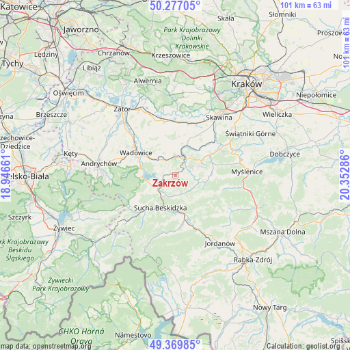
| Upper-left | 50.27705°, | 18.94661° |
| Center: | 49.82558°, | 19.64973° |
| Lower-right: | 49.36985°, | 20.35286° |
| Map W x H: | 100.9×100.9 km | = 62.7×62.7mi |
| max Lat: | 54.83135° ⇑90.8% North |
| Zakrzów: | 49.82558° |
| min Lat: | ⇓9.2% South 49.21328° |
| min Long | Zakrzów | max Long |
| 14.20249° | 19.64973° | 24.03723° |
| W 51.8%⇐ | ⇒48.2% E |
Elevation
Elevation of Zakrzów is 363 m = 1191 ft, and this is 171.6 m = 563 ft above average elevation for this country.
| Max E: |
974 m = 3196 ft | 7.4% |
| Zakrzów | 363 m 1191 ft | |
| Avg. | 191.4 m = 628 ft | |
Min E: |
-3 m = -10 ft | 92.6% |
See also: Poland elevation on elevation.city.
Geographical zone
Zakrzów is located in North temperate zone (between Tropic of Cancer and the Arctic Circle). Distance of this North polar circle is 1861.1 km =1156.4 mi to North.| Distance of | km | miles | from Zakrzów |
|---|---|---|---|
| North Pole | 4467 | 2775.7 | to North |
| Arctic Circle | 1861.1 | 1156.4 | to North |
| Tropic Cancer | 2934.2 | 1823.2 | to South |
| Equator | 5540.1 | 3442.5 | to South |


Nearby cities:
15 places around Zakrzów: (largest is in red/bold)
• Baczyn
6.3 km =3.9 mi,  125°
125°
• Barwałd Dolny
7.2 km =4.5 mi,  309°
309°
• Barwałd Górny
4.7 km =2.9 mi,  330°
330°
• Barwałd Średni
6.1 km =3.8 mi,  318°
318°
• Brody
5.8 km =3.6 mi,  36°
36°
• Budzów
5.7 km =3.5 mi,  163°
163°
• Kalwaria Zebrzydowska
5.1 km =3.2 mi,  22°
22°
• Lanckorona
5.2 km =3.2 mi,  65°
65°
• Marcówka
4.3 km =2.7 mi,  211°
211°
• Palcza
7.1 km =4.4 mi,  109°
109°
• Skawinki
4.5 km =2.8 mi,  93°
93°
• Stronie
1.9 km =1.2 mi, 72°
• Stryszów
2.3 km =1.4 mi,  270°
270°
• Zachełmna
4.1 km =2.5 mi,  136°
136°
• Zembrzyce
6.6 km =4.1 mi, 211°
Sources, notices
• [Note1] Compared only with cities in Poland existing in our database
• [Src1] Map data: © OpenStreetMap contributors (CC-BY-SA)
• [Src2] Other city data from geonames.org with taken over terms of usage.
• [Src3] Geographical zone / Annual Mean Temperature by Robert A. Rohde @ Wikipedia
