Wiślinka geodata
Wiślinka (Pomerania) is a populated place; located in Poland in Europe/Warsaw (GMT+2) time zone. With population of 939 people, there are 2611 cities with bigger population in this country. Compared to other cities in Poland, 97.9% of cities are located further ↓South; 63.4% of cities are located further →East and 100% of cities have higher elevation than Wiślinka. Note1


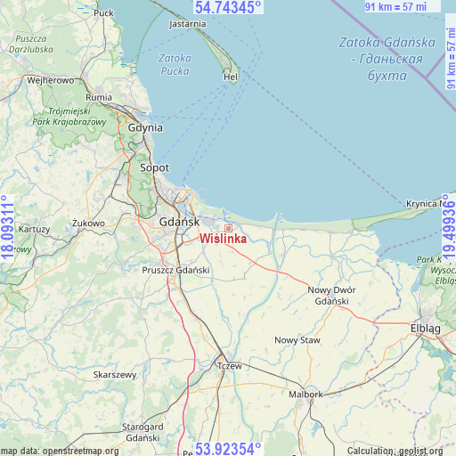
Wiślinka GPS coordinates[2]
54° 20' 7.944" North, 18° 47' 46.428" East
| Map corner | latitude | longitude |
|---|---|---|
| Upper-left | 54.74345°, | 18.09311° |
| Center: | 54.33554°, | 18.79623° |
| Lower-right: | 53.92354°, | 19.49936° |
| Map W x H: | 91.2×91.2 km | = 56.7×56.7mi |
| max Lat: | 54.83135° ⇑2.1% North |
| Wiślinka: | 54.33554° |
| min Lat: | ⇓97.9% South 49.21328° |
| min Long | Wiślinka | max Long |
| 14.20249° | 18.79623° | 24.03723° |
| W 36.6%⇐ | ⇒63.4% E |
Elevation
Elevation of Wiślinka is -3 m = -10 ft, and this is 194.4 m = 638 ft below average elevation for this country.
| Max E: |
974 m = 3196 ft | 100% |
| Avg. | 191.4 m = 628 ft | |
| Wiślinka | -3 m = -10 ft | |
Min E: |
-3 m = -10 ft | 0% |
See also: Poland elevation on elevation.city.
Geographical zone
Wiślinka is located in North temperate zone (between Tropic of Cancer and the Arctic Circle). Distance of this North polar circle is 1359.6 km =844.8 mi to North.| Distance of | km | miles | from Wiślinka |
|---|---|---|---|
| North Pole | 3965.5 | 2464 | to North |
| Arctic Circle | 1359.6 | 844.8 | to North |
| Tropic Cancer | 3435.6 | 2134.8 | to South |
| Equator | 6041.5 | 3754 | to South |


Nearby cities:
15 places around Wiślinka: (largest is in red/bold)
• Borkowo Łostowickie
13.6 km =8.5 mi,  252°
252°
• Cedry Wielkie
10.3 km =6.4 mi,  161°
161°
• Cieplewo
14.6 km =9.1 mi,  219°
219°
• Drewnica
11.7 km =7.3 mi,  117°
117°
• Gdańsk
9.9 km =6.2 mi,  280°
280°
• Jantar
15.4 km =9.6 mi,  89°
89°
• Juszkowo
15.4 km =9.6 mi,  235°
235°
• Kowale
15.5 km =9.6 mi,  259°
259°
• Mikoszewo
11.1 km =6.9 mi, 91°
• Pruszcz Gdański
13.2 km =8.2 mi,  231°
231°
• Przejazdowo
3.5 km =2.2 mi, 254°
• Rokitnica
9.9 km =6.2 mi, 226°
• Rotmanka
14.2 km =8.8 mi, 241°
• Straszyn
15.6 km =9.7 mi, 243°
• Suchy Dąb
14.3 km =8.9 mi,  187°
187°
Sources, notices
• [Note1] Compared only with cities in Poland existing in our database
• [Src1] Map data: © OpenStreetMap contributors (CC-BY-SA)
• [Src2] Other city data from geonames.org with taken over terms of usage.
• [Src3] Geographical zone / Annual Mean Temperature by Robert A. Rohde @ Wikipedia
