Kryspinów geodata
Kryspinów (Lesser Poland) is a populated place; located in Poland in Europe/Warsaw (GMT+2) time zone. With population of 1,360 people, there are 2014 cities with bigger population in this country. Compared to other cities in Poland, 80.3% of cities are located further ↑North; 54.9% of cities are located further ←West and 65.3% of cities have lower elevation than Kryspinów. Note1


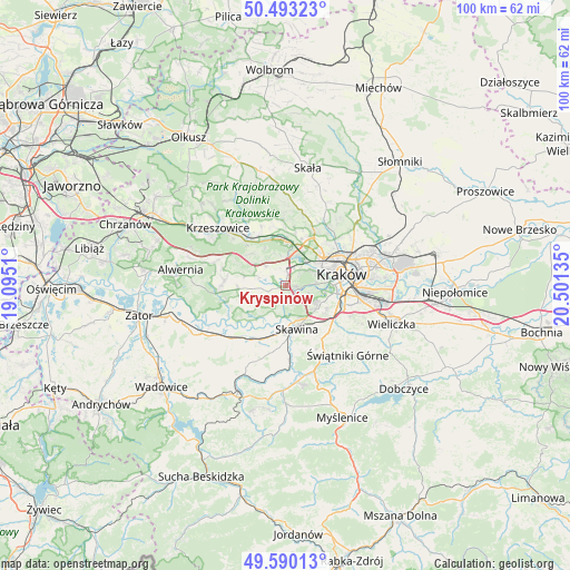
Kryspinów GPS coordinates[2]
50° 2' 37.68" North, 19° 47' 53.592" East
| Map corner | latitude | longitude |
|---|---|---|
| Upper-left | 50.49323°, | 19.0951° |
| Center: | 50.0438°, | 19.79822° |
| Lower-right: | 49.59013°, | 20.50135° |
| Map W x H: | 100.4×100.4 km | = 62.4×62.4mi |
| max Lat: | 54.83135° ⇑80.3% North |
| Kryspinów: | 50.0438° |
| min Lat: | ⇓19.7% South 49.21328° |
| min Long | Kryspinów | max Long |
| 14.20249° | 19.79822° | 24.03723° |
| W 54.9%⇐ | ⇒45.1% E |
Elevation
Elevation of Kryspinów is 215 m = 705 ft, and this is 23.6 m = 77 ft above average elevation for this country.
| Max E: |
974 m = 3196 ft | 34.7% |
| Kryspinów | 215 m 705 ft | |
| Avg. | 191.4 m = 628 ft | |
Min E: |
-3 m = -10 ft | 65.3% |
See also: Poland elevation on elevation.city.
Geographical zone
Kryspinów is located in North temperate zone (between Tropic of Cancer and the Arctic Circle). Distance of this North polar circle is 1836.8 km =1141.3 mi to North.| Distance of | km | miles | from Kryspinów |
|---|---|---|---|
| North Pole | 4442.7 | 2760.6 | to North |
| Arctic Circle | 1836.8 | 1141.3 | to North |
| Tropic Cancer | 2958.4 | 1838.3 | to South |
| Equator | 5564.3 | 3457.5 | to South |


Nearby cities:
15 places around Kryspinów: (largest is in red/bold)
• Aleksandrowice
4.9 km =3 mi,  330°
330°
• Balice
4.9 km =3 mi,  357°
357°
• Cholerzyn
3 km =1.9 mi,  305°
305°
• Czułów
7.2 km =4.5 mi,  284°
284°
• Jeziorzany
5.7 km =3.5 mi,  196°
196°
• Kaszów
5.7 km =3.5 mi,  264°
264°
• Kopanka
6.7 km =4.2 mi,  183°
183°
• Liszki
2.2 km =1.4 mi, 255°
• Mników
5.5 km =3.4 mi,  289°
289°
• Morawica
4.7 km =2.9 mi,  317°
317°
• Piekary
2.1 km =1.3 mi, 184°
• Rząska
6.8 km =4.2 mi,  29°
29°
• Rączna
4.4 km =2.7 mi,  209°
209°
• Szczyglice
5.8 km =3.6 mi,  21°
21°
• Ściejowice
4.5 km =2.8 mi, 196°
Sources, notices
• [Note1] Compared only with cities in Poland existing in our database
• [Src1] Map data: © OpenStreetMap contributors (CC-BY-SA)
• [Src2] Other city data from geonames.org with taken over terms of usage.
• [Src3] Geographical zone / Annual Mean Temperature by Robert A. Rohde @ Wikipedia
