Wisznice geodata
Wisznice (Lublin) is a populated place; located in Poland in Europe/Warsaw (GMT+2) time zone. With population of 1,559 people, there are 1797 cities with bigger population in this country. Compared to other cities in Poland, 61.9% of cities are located further ↓South; 97.5% of cities are located further ←West and 57.6% of cities have higher elevation than Wisznice. Note1


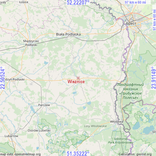
Wisznice GPS coordinates[2]
51° 47' 21.264" North, 23° 12' 30.096" East
| Map corner | latitude | longitude |
|---|---|---|
| Upper-left | 52.22207°, | 22.50524° |
| Center: | 51.78924°, | 23.20836° |
| Lower-right: | 51.35222°, | 23.91149° |
| Map W x H: | 96.7×96.7 km | = 60.1×60.1mi |
| max Lat: | 54.83135° ⇑38.1% North |
| Wisznice: | 51.78924° |
| min Lat: | ⇓61.9% South 49.21328° |
| min Long | Wisznice | max Long |
| 14.20249° | 23.20836° | 24.03723° |
| W 97.5%⇐ | ⇒2.5% E |
Elevation
Elevation of Wisznice is 152 m = 499 ft, and this is 39.4 m = 129 ft below average elevation for this country.
| Max E: |
974 m = 3196 ft | 57.6% |
| Avg. | 191.4 m = 628 ft | |
| Wisznice | 152 m = 499 ft | |
Min E: |
-3 m = -10 ft | 42.4% |
See also: Poland elevation on elevation.city.
Geographical zone
Wisznice is located in North temperate zone (between Tropic of Cancer and the Arctic Circle). Distance of this North polar circle is 1642.8 km =1020.8 mi to North.| Distance of | km | miles | from Wisznice |
|---|---|---|---|
| North Pole | 4248.6 | 2640 | to North |
| Arctic Circle | 1642.8 | 1020.8 | to North |
| Tropic Cancer | 3152.5 | 1958.9 | to South |
| Equator | 5758.4 | 3578.1 | to South |


Nearby cities:
15 places around Wisznice: (largest is in red/bold)
• Drelów
26.9 km =16.7 mi,  300°
300°
• Dębowa Kłoda
25.7 km =16 mi,  212°
212°
• Hanna
21.8 km =13.5 mi,  111°
111°
• Jabłoń
11 km =6.8 mi,  229°
229°
• Komarówka Podlaska
18.3 km =11.4 mi,  274°
274°
• Kostry
22.7 km =14.1 mi,  242°
242°
• Milanów
24 km =14.9 mi,  246°
246°
• Parczew
26.9 km =16.7 mi, 231°
• Piszczac
24.3 km =15.1 mi,  28°
28°
• Podedwórze
11.3 km =7 mi,  183°
183°
• Rossosz
9.1 km =5.7 mi,  327°
327°
• Sosnówka
9.9 km =6.2 mi,  115°
115°
• Sławatycze
24 km =14.9 mi,  96°
96°
• Tuczna
18 km =11.2 mi,  55°
55°
• Łomazy
13 km =8.1 mi,  350°
350°
Sources, notices
• [Note1] Compared only with cities in Poland existing in our database
• [Src1] Map data: © OpenStreetMap contributors (CC-BY-SA)
• [Src2] Other city data from geonames.org with taken over terms of usage.
• [Src3] Geographical zone / Annual Mean Temperature by Robert A. Rohde @ Wikipedia
