Sławatycze geodata
Sławatycze (Lublin) is a seat of a third-order administrative division; located in Poland in Europe/Warsaw (GMT+2) time zone. With population of 2,647 people, there are 1189 cities with bigger population in this country. Compared to other cities in Poland, 61.2% of cities are located further ↓South; 99% of cities are located further ←West and 56.7% of cities have higher elevation than Sławatycze. Note1


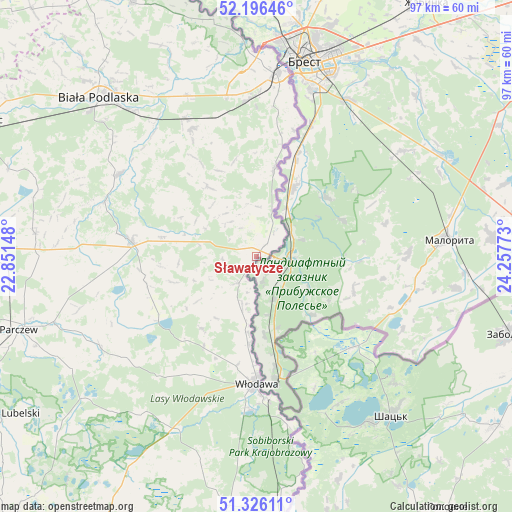
Sławatycze GPS coordinates[2]
51° 45' 48.168" North, 23° 33' 16.56" East
| Map corner | latitude | longitude |
|---|---|---|
| Upper-left | 52.19646°, | 22.85148° |
| Center: | 51.76338°, | 23.5546° |
| Lower-right: | 51.32611°, | 24.25773° |
| Map W x H: | 96.8×96.8 km | = 60.1×60.1mi |
| max Lat: | 54.83135° ⇑38.8% North |
| Sławatycze: | 51.76338° |
| min Lat: | ⇓61.2% South 49.21328° |
| min Long | Sławatycze | max Long |
| 14.20249° | 23.5546° | 24.03723° |
| W 99%⇐ | ⇒1% E |
Elevation
Elevation of Sławatycze is 154 m = 505 ft, and this is 37.4 m = 123 ft below average elevation for this country.
| Max E: |
974 m = 3196 ft | 56.7% |
| Avg. | 191.4 m = 628 ft | |
| Sławatycze | 154 m = 505 ft | |
Min E: |
-3 m = -10 ft | 43.3% |
See also: Poland elevation on elevation.city.
Geographical zone
Sławatycze is located in North temperate zone (between Tropic of Cancer and the Arctic Circle). Distance of this North polar circle is 1645.6 km =1022.5 mi to North.| Distance of | km | miles | from Sławatycze |
|---|---|---|---|
| North Pole | 4251.5 | 2641.8 | to North |
| Arctic Circle | 1645.6 | 1022.5 | to North |
| Tropic Cancer | 3149.6 | 1957.1 | to South |
| Equator | 5755.5 | 3576.3 | to South |


Nearby cities:
15 places around Sławatycze: (largest is in red/bold)
• Hanna
6 km =3.7 mi,  215°
215°
• Hańsk
40.4 km =25.1 mi,  195°
195°
• Jabłoń
32.4 km =20.1 mi,  262°
262°
• Kodeń
16.8 km =10.4 mi,  11°
11°
• Kostomłoty
24.7 km =15.3 mi,  16°
16°
• Piszczac
27.1 km =16.8 mi,  333°
333°
• Podedwórze
25.8 km =16 mi,  251°
251°
• Rossosz
30.6 km =19 mi,  290°
290°
• Sosnówka
15 km =9.3 mi, 264°
• Terespol
35 km =21.7 mi, 6°
• Tuczna
15.8 km =9.8 mi, 325°
• Wisznice
24 km =14.9 mi,  276°
276°
• Włodawa
23.7 km =14.7 mi,  180°
180°
• Zalesie
33.2 km =20.6 mi,  336°
336°
• Łomazy
30.3 km =18.8 mi,  301°
301°
Sources, notices
• [Note1] Compared only with cities in Poland existing in our database
• [Src1] Map data: © OpenStreetMap contributors (CC-BY-SA)
• [Src2] Other city data from geonames.org with taken over terms of usage.
• [Src3] Geographical zone / Annual Mean Temperature by Robert A. Rohde @ Wikipedia
