Milanów geodata
Milanów (Lublin) is a seat of a third-order administrative division; located in Poland in Europe/Warsaw (GMT+2) time zone. With population of 1,105 people, there are 2301 cities with bigger population in this country. Compared to other cities in Poland, 60.2% of cities are located further ↓South; 95.1% of cities are located further ←West and 56% of cities have higher elevation than Milanów. Note1


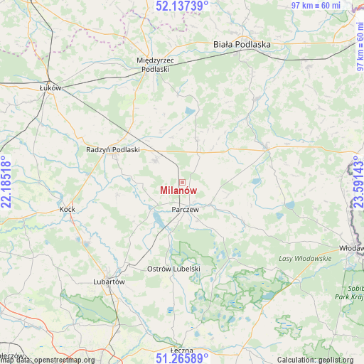
Milanów GPS coordinates[2]
51° 42' 13.464" North, 22° 53' 17.88" East
| Map corner | latitude | longitude |
|---|---|---|
| Upper-left | 52.13739°, | 22.18518° |
| Center: | 51.70374°, | 22.8883° |
| Lower-right: | 51.26589°, | 23.59143° |
| Map W x H: | 96.9×96.9 km | = 60.2×60.2mi |
| max Lat: | 54.83135° ⇑39.8% North |
| Milanów: | 51.70374° |
| min Lat: | ⇓60.2% South 49.21328° |
| min Long | Milanów | max Long |
| 14.20249° | 22.8883° | 24.03723° |
| W 95.1%⇐ | ⇒4.9% E |
Elevation
Elevation of Milanów is 156 m = 512 ft, and this is 35.4 m = 116 ft below average elevation for this country.
| Max E: |
974 m = 3196 ft | 56% |
| Avg. | 191.4 m = 628 ft | |
| Milanów | 156 m = 512 ft | |
Min E: |
-3 m = -10 ft | 44% |
See also: Poland elevation on elevation.city.
Geographical zone
Milanów is located in North temperate zone (between Tropic of Cancer and the Arctic Circle). Distance of this North polar circle is 1652.3 km =1026.7 mi to North.| Distance of | km | miles | from Milanów |
|---|---|---|---|
| North Pole | 4258.1 | 2645.9 | to North |
| Arctic Circle | 1652.3 | 1026.7 | to North |
| Tropic Cancer | 3143 | 1953 | to South |
| Equator | 5748.9 | 3572.2 | to South |


Nearby cities:
15 places around Milanów: (largest is in red/bold)
• Brzeźnica Bychawska
21.7 km =13.5 mi,  205°
205°
• Czemierniki
17.5 km =10.9 mi,  258°
258°
• Drelów
23.2 km =14.4 mi,  357°
357°
• Dębowa Kłoda
14.6 km =9.1 mi,  146°
146°
• Jabłoń
13.9 km =8.6 mi,  80°
80°
• Komarówka Podlaska
11.7 km =7.3 mi,  19°
19°
• Kostry
2 km =1.2 mi,  114°
114°
• Niedźwiada
22.4 km =13.9 mi,  217°
217°
• Ostrów Lubelski
23.4 km =14.5 mi,  185°
185°
• Ostrówek
23.4 km =14.5 mi,  234°
234°
• Parczew
7.1 km =4.4 mi,  173°
173°
• Podedwórze
21.5 km =13.4 mi,  94°
94°
• Radzyń Podlaski
20.7 km =12.9 mi,  295°
295°
• Siemień
11.5 km =7.1 mi, 223°
• Wohyń
9.2 km =5.7 mi,  309°
309°
Sources, notices
• [Note1] Compared only with cities in Poland existing in our database
• [Src1] Map data: © OpenStreetMap contributors (CC-BY-SA)
• [Src2] Other city data from geonames.org with taken over terms of usage.
• [Src3] Geographical zone / Annual Mean Temperature by Robert A. Rohde @ Wikipedia
