Wiązownica geodata
Wiązownica (Subcarpathian) is a populated place; located in Poland in Europe/Warsaw (GMT+2) time zone. With population of 1,700 people, there are 1678 cities with bigger population in this country. Compared to other cities in Poland, 78.8% of cities are located further ↑North; 93.9% of cities are located further ←West and 53% of cities have lower elevation than Wiązownica. Note1


Wiązownica GPS coordinates[2]
50° 4' 50.376" North, 22° 42' 24.048" East
| Map corner | latitude | longitude |
|---|---|---|
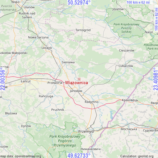
| Upper-left | 50.52974°, | 22.00356° |
| Center: | 50.08066°, | 22.70668° |
| Lower-right: | 49.62733°, | 23.40981° |
| Map W x H: | 100.3×100.3 km | = 62.3×62.3mi |
| max Lat: | 54.83135° ⇑78.8% North |
| Wiązownica: | 50.08066° |
| min Lat: | ⇓21.2% South 49.21328° |
| min Long | Wiązownica | max Long |
| 14.20249° | 22.70668° | 24.03723° |
| W 93.9%⇐ | ⇒6.1% E |
Elevation
Elevation of Wiązownica is 180 m = 591 ft, and this is 11.4 m = 37 ft below average elevation for this country.
| Max E: |
974 m = 3196 ft | 47% |
| Avg. | 191.4 m = 628 ft | |
| Wiązownica | 180 m = 591 ft | |
Min E: |
-3 m = -10 ft | 53% |
See also: Poland elevation on elevation.city.
Geographical zone
Wiązownica is located in North temperate zone (between Tropic of Cancer and the Arctic Circle). Distance of this North polar circle is 1832.7 km =1138.8 mi to North.| Distance of | km | miles | from Wiązownica |
|---|---|---|---|
| North Pole | 4438.6 | 2758 | to North |
| Arctic Circle | 1832.7 | 1138.8 | to North |
| Tropic Cancer | 2962.5 | 1840.8 | to South |
| Equator | 5568.4 | 3460 | to South |


Nearby cities:
15 places around Wiązownica: (largest is in red/bold)
• Cieszacin Wielki
12.6 km =7.8 mi,  219°
219°
• Gorzyce
10.5 km =6.5 mi,  300°
300°
• Jagiełła
9.7 km =6 mi,  279°
279°
• Jankowice
13.7 km =8.5 mi,  197°
197°
• Jarosław
7.5 km =4.7 mi, 196°
• Leżachów
9.6 km =6 mi,  318°
318°
• Mirocin
11.6 km =7.2 mi,  248°
248°
• Pawłosiów
10.4 km =6.5 mi, 203°
• Rozbórz
11.7 km =7.3 mi,  256°
256°
• Sieniawa
12.8 km =8 mi,  327°
327°
• Ubieszyn
13 km =8.1 mi, 315°
• Ujezna
8.4 km =5.2 mi, 260°
• Wierzbna
9.2 km =5.7 mi,  234°
234°
• Wylewa
13.7 km =8.5 mi, 334°
• Wólka Pełkińska
6.2 km =3.9 mi,  285°
285°
Sources, notices
• [Note1] Compared only with cities in Poland existing in our database
• [Src1] Map data: © OpenStreetMap contributors (CC-BY-SA)
• [Src2] Other city data from geonames.org with taken over terms of usage.
• [Src3] Geographical zone / Annual Mean Temperature by Robert A. Rohde @ Wikipedia
