Legionowo geodata
Legionowo (Mazovia) is a seat of a third-order administrative division; located in Poland in Europe/Warsaw (GMT+2) time zone. With population of 50,786 people, there are 99 cities with bigger population in this country. Compared to other cities in Poland, 74.7% of cities are located further ↓South; 71.1% of cities are located further ←West and 89.6% of cities have higher elevation than Legionowo. Note1


Legionowo GPS coordinates[2]
52° 24' 5.364" North, 20° 55' 35.904" East
| Map corner | latitude | longitude |
|---|---|---|
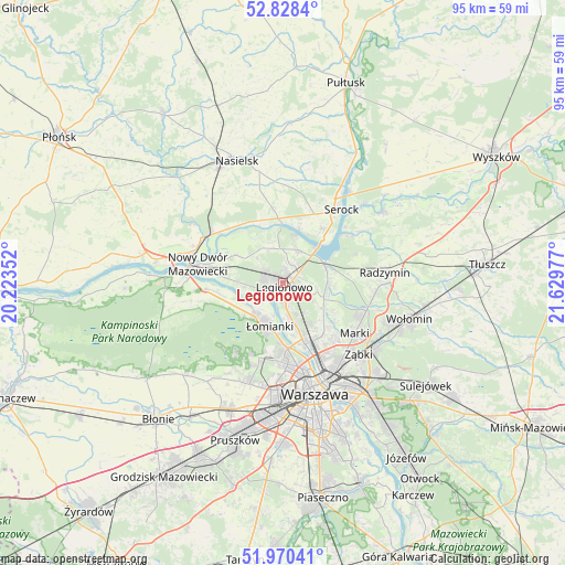
| Upper-left | 52.8284°, | 20.22352° |
| Center: | 52.40149°, | 20.92664° |
| Lower-right: | 51.97041°, | 21.62977° |
| Map W x H: | 95.4×95.4 km | = 59.3×59.3mi |
| max Lat: | 54.83135° ⇑25.3% North |
| Legionowo: | 52.40149° |
| min Lat: | ⇓74.7% South 49.21328° |
| min Long | Legionowo | max Long |
| 14.20249° | 20.92664° | 24.03723° |
| W 71.1%⇐ | ⇒28.9% E |
Elevation
Elevation of Legionowo is 77 m = 253 ft, and this is 114.4 m = 375 ft below average elevation for this country.
| Max E: |
974 m = 3196 ft | 89.6% |
| Avg. | 191.4 m = 628 ft | |
| Legionowo | 77 m = 253 ft | |
Min E: |
-3 m = -10 ft | 10.4% |
See also: Legionowo elevation on elevation.city.
Geographical zone
Legionowo is located in North temperate zone (between Tropic of Cancer and the Arctic Circle). Distance of this North polar circle is 1574.7 km =978.5 mi to North.| Distance of | km | miles | from Legionowo |
|---|---|---|---|
| North Pole | 4180.6 | 2597.7 | to North |
| Arctic Circle | 1574.7 | 978.5 | to North |
| Tropic Cancer | 3220.6 | 2001.2 | to South |
| Equator | 5826.5 | 3620.4 | to South |


Nearby cities:
15 places around Legionowo: (largest is in red/bold)
• Białobrzegi
9.7 km =6 mi,  62°
62°
• Białołeka
9.4 km =5.8 mi,  160°
160°
• Bielany
12.1 km =7.5 mi,  177°
177°
• Dziekanów Bajkowy
7 km =4.3 mi,  226°
226°
• Dziekanów Leśny
7.5 km =4.7 mi,  223°
223°
• Jabłonna
2.6 km =1.6 mi,  193°
193°
• Kiełpin
6.5 km =4 mi, 222°
• Michałów-Reginów
3.2 km =2 mi, 56°
• Nieporęt
7.9 km =4.9 mi, 64°
• Stanisławów
2.7 km =1.7 mi,  67°
67°
• Stanisławów Pierwszy
9 km =5.6 mi,  109°
109°
• Wieliszew
6.2 km =3.9 mi,  27°
27°
• Łajski
3.4 km =2.1 mi, 27°
• Łomianki
8 km =5 mi,  200°
200°
• Łomna
10.3 km =6.4 mi,  258°
258°
Sources, notices
• [Note1] Compared only with cities in Poland existing in our database
• [Src1] Map data: © OpenStreetMap contributors (CC-BY-SA)
• [Src2] Other city data from geonames.org with taken over terms of usage.
• [Src3] Geographical zone / Annual Mean Temperature by Robert A. Rohde @ Wikipedia
