Al Mughrāqah geodata
Al Mughrāqah (Gaza Strip) is a populated place; located in Palestinian Territory in Asia/Gaza (GMT+3) time zone. With population of 6,448 people, there are 85 cities with bigger population in this country. Compared to other cities in Palestinian Territory, 90.3% of cities are located further ↑North; 95.9% of cities are located further →East and 96.9% of cities have higher elevation than Al Mughrāqah. Note1


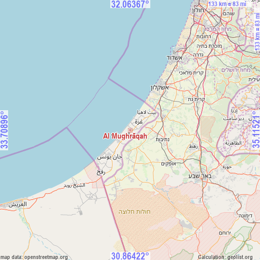
Al Mughrāqah GPS coordinates[2]
31° 27' 57.132" North, 34° 24' 43.488" East
| Map corner | latitude | longitude |
|---|---|---|
| Upper-left | 32.06367°, | 33.70896° |
| Center: | 31.46587°, | 34.41208° |
| Lower-right: | 30.86422°, | 35.11521° |
| Map W x H: | 133.4×133.4 km | = 82.9×82.9mi |
| max Lat: | 32.54346° ⇑90.3% North |
| Al Mughrāqah: | 31.46587° |
| min Lat: | ⇓9.7% South 31.25997° |
| min Long | Al Mughrāqah | max Long |
| 34.24357° | 34.41208° | 35.53898° |
| W 4.1%⇐ | ⇒95.9% E |
Elevation
Elevation of Al Mughrāqah is 14 m = 46 ft, and this is 459.3 m = 1507 ft below average elevation for this country.
| Max E: |
999 m = 3278 ft | 96.9% |
| Avg. | 473.3 m = 1553 ft | |
| Al Mughrāqah | 14 m = 46 ft | |
Min E: |
-269 m = -883 ft | 3.1% |
See also: Palestinian Territory elevation on elevation.city.
Geographical zone
Al Mughrāqah is located in North temperate zone (between Tropic of Cancer and the Arctic Circle). Distance of this Northern Tropic circle is 892.8 km =554.8 mi to South.| Distance of | km | miles | from Al Mughrāqah |
|---|---|---|---|
| North Pole | 6508.4 | 4044.1 | to North |
| Arctic Circle | 3902.5 | 2424.9 | to North |
| Tropic Cancer | 892.8 | 554.8 | to South |
| Equator | 3498.7 | 2174 | to South |


Nearby cities:
15 places around Al Mughrāqah: (largest is in red/bold)
• Al Burayj
3.1 km =1.9 mi,  196°
196°
• Al Muşaddar
7 km =4.3 mi,  207°
207°
• Al Qarārah
12.3 km =7.6 mi, 213°
• An Nuşayrāt
2.7 km =1.7 mi,  224°
224°
• Az Zuwāydah
4.2 km =2.6 mi,  225°
225°
• Banī Suhaylā
16 km =9.9 mi, 211°
• Bayt Lāhyā
11.9 km =7.4 mi,  41°
41°
• Bayt Ḩānūn
14 km =8.7 mi,  56°
56°
• Dayr al Balaḩ
7.9 km =4.9 mi, 227°
• Gaza
6.5 km =4 mi,  52°
52°
• Jabālyā
9.6 km =6 mi, 44°
• Juḩr ad Dīk
2.6 km =1.6 mi,  115°
115°
• Umm an Naşr
14.6 km =9.1 mi, 43°
• Wādī as Salqā
10.1 km =6.3 mi, 224°
• ‘Abasān al Jadīdah
15.2 km =9.4 mi, 204°
Sources, notices
• [Note1] Compared only with cities in Palestinian Territory existing in our database
• [Src1] Map data: © OpenStreetMap contributors (CC-BY-SA)
• [Src2] Other city data from geonames.org with taken over terms of usage.
• [Src3] Geographical zone / Annual Mean Temperature by Robert A. Rohde @ Wikipedia
