Al ‘Awjā geodata
Al ‘Awjā (West Bank) is a populated place; located in Palestinian Territory in Asia/Hebron (GMT+3) time zone. With population of 4,067 people, there are 136 cities with bigger population in this country. Compared to other cities in Palestinian Territory, 56.7% of cities are located further ↑North; 98.7% of cities are located further ←West and 99% of cities have higher elevation than Al ‘Awjā. Note1


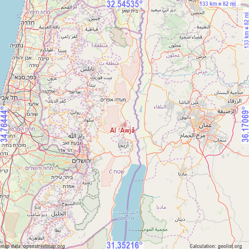
Al ‘Awjā GPS coordinates[2]
31° 57' 2.484" North, 35° 28' 3.216" East
| Map corner | latitude | longitude |
|---|---|---|
| Upper-left | 32.54535°, | 34.76444° |
| Center: | 31.95069°, | 35.46756° |
| Lower-right: | 31.35216°, | 36.17069° |
| Map W x H: | 132.7×132.7 km | = 82.5×82.5mi |
| max Lat: | 32.54346° ⇑56.7% North |
| Al ‘Awjā: | 31.95069° |
| min Lat: | ⇓43.3% South 31.25997° |
| min Long | Al ‘Awjā | max Long |
| 34.24357° | 35.46756° | 35.53898° |
| W 98.7%⇐ | ⇒1.3% E |
Elevation
Elevation of Al ‘Awjā is -241 m = -791 ft, and this is 714.3 m = 2344 ft below average elevation for this country.
| Max E: |
999 m = 3278 ft | 99% |
| Avg. | 473.3 m = 1553 ft | |
| Al ‘Awjā | -241 m = -791 ft | |
Min E: |
-269 m = -883 ft | 1% |
See also: Palestinian Territory elevation on elevation.city.
Geographical zone
Al ‘Awjā is located in North temperate zone (between Tropic of Cancer and the Arctic Circle). Distance of this Northern Tropic circle is 946.7 km =588.3 mi to South.| Distance of | km | miles | from Al ‘Awjā |
|---|---|---|---|
| North Pole | 6454.5 | 4010.6 | to North |
| Arctic Circle | 3848.6 | 2391.4 | to North |
| Tropic Cancer | 946.7 | 588.3 | to South |
| Equator | 3552.6 | 2207.5 | to South |


Nearby cities:
15 places around Al ‘Awjā: (largest is in red/bold)
• Al Faşāyil
8.6 km =5.3 mi,  344°
344°
• Al Mazra‘ah ash Sharqīyah
18.4 km =11.4 mi,  287°
287°
• Al Mughayyir
13.6 km =8.5 mi,  304°
304°
• An Nuway‘imah
7.2 km =4.5 mi,  204°
204°
• Aţ Ţaybah
15.8 km =9.8 mi,  271°
271°
• Badiw al Mu‘arrajāt
14.4 km =8.9 mi,  258°
258°
• Dayr Dibwān
19.5 km =12.1 mi, 256°
• Dayr Jarīr
16.6 km =10.3 mi,  276°
276°
• Domea
15.1 km =9.4 mi,  321°
321°
• Jericho
9.5 km =5.9 mi,  190°
190°
• Kafr Mālik
15.5 km =9.6 mi, 285°
• Khirbat Abū Falāḩ
17.3 km =10.7 mi, 295°
• Majdal Banī Fāḑil
17.7 km =11 mi,  326°
326°
• Rammūn
16.1 km =10 mi, 263°
• ‘Ayn ad Duyūk al Fawqā
8 km =5 mi,  208°
208°
Sources, notices
• [Note1] Compared only with cities in Palestinian Territory existing in our database
• [Src1] Map data: © OpenStreetMap contributors (CC-BY-SA)
• [Src2] Other city data from geonames.org with taken over terms of usage.
• [Src3] Geographical zone / Annual Mean Temperature by Robert A. Rohde @ Wikipedia
