‘Ayn ad Duyūk al Fawqā geodata
‘Ayn ad Duyūk al Fawqā (West Bank) is a populated place; located in Palestinian Territory in Asia/Hebron (GMT+3) time zone. With population of 810 people, there are 349 cities with bigger population in this country. Compared to other cities in Palestinian Territory, 63.4% of cities are located further ↑North; 97.7% of cities are located further ←West and 98.2% of cities have higher elevation than ‘Ayn ad Duyūk al Fawqā. Note1
Current local time in ‘Ayn ad Duyūk al Fawqā:
10:21 PM, ThursdayDifference from your time zone: hours


‘Ayn ad Duyūk al Fawqā GPS coordinates[2]
31° 53' 13.524" North, 35° 25' 37.956" East
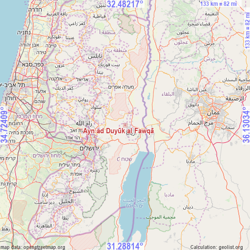
| Map corner | latitude | longitude |
|---|---|---|
| Upper-left | 32.48217°, | 34.72409° |
| Center: | 31.88709°, | 35.42721° |
| Lower-right: | 31.28814°, | 36.13034° |
| Map W x H: | 132.8×132.8 km | = 82.5×82.5mi |
| max Lat: | 32.54346° ⇑63.4% North |
| ‘Ayn ad Duyūk al Fawqā: | 31.88709° |
| min Lat: | ⇓36.6% South 31.25997° |
| min Long | ‘Ayn ad Duyū | max Long |
| 34.24357° | 35.42721° | 35.53898° |
| W 97.7%⇐ | ⇒2.3% E |
Elevation
Elevation of ‘Ayn ad Duyūk al Fawqā is -138 m = -453 ft, and this is 611.3 m = 2006 ft below average elevation for this country.
| Max E: |
999 m = 3278 ft | 98.2% |
| Avg. | 473.3 m = 1553 ft | |
| ‘Ayn ad Duyūk al Fawqā | -138 m = -453 ft | |
Min E: |
-269 m = -883 ft | 1.8% |
See also: Palestinian Territory elevation on elevation.city.
Geographical zone
‘Ayn ad Duyūk al Fawqā is located in North temperate zone (between Tropic of Cancer and the Arctic Circle). Distance of this Northern Tropic circle is 939.6 km =583.8 mi to South.| Distance of | km | miles | from ‘Ayn ad Duyūk al Fawqā |
|---|---|---|---|
| North Pole | 6461.5 | 4015 | to North |
| Arctic Circle | 3855.7 | 2395.8 | to North |
| Tropic Cancer | 939.6 | 583.8 | to South |
| Equator | 3545.5 | 2203.1 | to South |


Nearby cities:
15 places around ‘Ayn ad Duyūk al Fawqā: (largest is in red/bold)
• Al Faşāyil
15.4 km =9.6 mi,  5°
5°
• Al Ka‘ābinah (Tajammu‘ Badawī)
12.9 km =8 mi,  226°
226°
• Al Mughayyir
16.5 km =10.3 mi,  332°
332°
• Al ‘Awjā
8 km =5 mi,  28°
28°
• An Nuway‘imah
1 km =0.6 mi,  54°
54°
• Aţ Ţaybah
14.1 km =8.8 mi,  301°
301°
• Badiw al Mu‘arrajāt
11.1 km =6.9 mi,  292°
292°
• Burqah
16.4 km =10.2 mi,  273°
273°
• Dayr Dibwān
15.4 km =9.6 mi,  279°
279°
• Dayr Jarīr
15.5 km =9.6 mi, 304°
• Jaba‘
16.3 km =10.1 mi,  258°
258°
• Jericho
3.1 km =1.9 mi,  136°
136°
• Kafr Mālik
15.8 km =9.8 mi,  315°
315°
• Mikhmās
14.4 km =8.9 mi, 263°
• Rammūn
13.2 km =8.2 mi, 292°
Sources, notices
• [Note1] Compared only with cities in Palestinian Territory existing in our database
• [Src1] Map data: © OpenStreetMap contributors (CC-BY-SA)
• [Src2] Other city data from geonames.org with taken over terms of usage.
• [Src3] Geographical zone / Annual Mean Temperature by Robert A. Rohde @ Wikipedia
