São Bartolomeu de Messines geodata
São Bartolomeu de Messines (Faro) is a populated place; located in Portugal in Europe/Lisbon (GMT+1) time zone. With population of 8,381 people, there are 268 cities with bigger population in this country. Compared to other cities in Portugal, 90.4% of cities are located further ↑North; 69.6% of cities are located further ←West and 55.4% of cities have lower elevation than São Bartolomeu de Messines. Note1
Current local time in São Bartolomeu de Messines:
11:52 PM, WednesdayDifference from your time zone: hours


São Bartolomeu de Messines GPS coordinates[2]
37° 15' 23.328" North, 8° 17' 12.192" West
| Map corner | latitude | longitude |
|---|---|---|
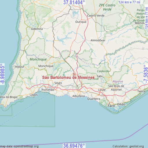
| Upper-left | 37.81404°, | -8.98985° |
| Center: | 37.25648°, | -8.28672° |
| Lower-right: | 36.69476°, | -7.5836° |
| Map W x H: | 124.5×124.5 km | = 77.4×77.4mi |
| max Lat: | 42.11337° ⇑90.4% North |
| São Bartolomeu de Messines: | 37.25648° |
| min Lat: | ⇓9.6% South 32.6448° |
| min Long | São Bartolomeu | max Long |
| -31.17847° | -8.28672° | -6.27308° |
| W 69.6%⇐ | ⇒30.4% E |
Elevation
Elevation of São Bartolomeu de Messines is 130 m = 427 ft, and this is 47 m = 154 ft below average elevation for this country.
| Max E: |
1008 m = 3307 ft | 44.6% |
| Avg. | 177 m = 581 ft | |
| São Bartolomeu de Messines | 130 m = 427 ft | |
Min E: |
-128 m = -420 ft | 55.4% |
See also: Portugal elevation on elevation.city.
Geographical zone
São Bartolomeu de Messines is located in North temperate zone (between Tropic of Cancer and the Arctic Circle). Distance of this Northern Tropic circle is 1536.6 km =954.8 mi to South.| Distance of | km | miles | from São Bartolomeu de Messines |
|---|---|---|---|
| North Pole | 5864.5 | 3644 | to North |
| Arctic Circle | 3258.6 | 2024.8 | to North |
| Tropic Cancer | 1536.6 | 954.8 | to South |
| Equator | 4142.5 | 2574 | to South |


Nearby cities:
15 places around São Bartolomeu de Messines: (largest is in red/bold)
• Albufeira
19 km =11.8 mi,  170°
170°
• Alcantarilha
15 km =9.3 mi,  200°
200°
• Algoz
10.5 km =6.5 mi,  188°
188°
• Armação de Pêra
18.2 km =11.3 mi, 199°
• Boliqueime
17.5 km =10.9 mi,  139°
139°
• Ferreiras
14.8 km =9.2 mi,  162°
162°
• Guia
14.2 km =8.8 mi,  184°
184°
• Lagoa
20 km =12.4 mi,  227°
227°
• Olhos de Água
20.3 km =12.6 mi, 155°
• Paderne
11.4 km =7.1 mi, 138°
• Porches
17.7 km =11 mi,  215°
215°
• Pêra
15.6 km =9.7 mi, 197°
• Silves
15.4 km =9.6 mi,  240°
240°
• São Marcos da Serra
14.1 km =8.8 mi,  325°
325°
• Tunes
10.4 km =6.5 mi, 166°
Sources, notices
• [Note1] Compared only with cities in Portugal existing in our database
• [Src1] Map data: © OpenStreetMap contributors (CC-BY-SA)
• [Src2] Other city data from geonames.org with taken over terms of usage.
• [Src3] Geographical zone / Annual Mean Temperature by Robert A. Rohde @ Wikipedia
