Meca geodata
Meca (Lisbon) is a populated place; located in Portugal in Europe/Lisbon (GMT+1) time zone. With population of 1,719 people, there are 673 cities with bigger population in this country. Compared to other cities in Portugal, 62.4% of cities are located further ↑North; 75.5% of cities are located further →East and 50.7% of cities have higher elevation than Meca. Note1


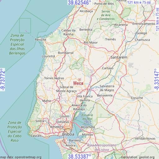
Meca GPS coordinates[2]
39° 4' 54.408" North, 9° 2' 4.524" West
| Map corner | latitude | longitude |
|---|---|---|
| Upper-left | 39.62546°, | -9.73772° |
| Center: | 39.08178°, | -9.03459° |
| Lower-right: | 38.53387°, | -8.33147° |
| Map W x H: | 121.4×121.4 km | = 75.4×75.4mi |
| max Lat: | 42.11337° ⇑62.4% North |
| Meca: | 39.08178° |
| min Lat: | ⇓37.6% South 32.6448° |
| min Long | Meca | max Long |
| -31.17847° | -9.03459° | -6.27308° |
| W 24.5%⇐ | ⇒75.5% E |
Elevation
Elevation of Meca is 110 m = 361 ft, and this is 67 m = 220 ft below average elevation for this country.
| Max E: |
1008 m = 3307 ft | 50.7% |
| Avg. | 177 m = 581 ft | |
| Meca | 110 m = 361 ft | |
Min E: |
-128 m = -420 ft | 49.3% |
See also: Portugal elevation on elevation.city.
Geographical zone
Meca is located in North temperate zone (between Tropic of Cancer and the Arctic Circle). Distance of this Northern Tropic circle is 1739.6 km =1080.9 mi to South.| Distance of | km | miles | from Meca |
|---|---|---|---|
| North Pole | 5661.6 | 3518 | to North |
| Arctic Circle | 3055.7 | 1898.7 | to North |
| Tropic Cancer | 1739.6 | 1080.9 | to South |
| Equator | 4345.5 | 2700.2 | to South |


Nearby cities:
15 places around Meca: (largest is in red/bold)
• Abrigada
7.1 km =4.4 mi,  11°
11°
• Alenquer
3.9 km =2.4 mi,  145°
145°
• Arruda dos Vinhos
11.5 km =7.1 mi,  198°
198°
• Aveiras de Cima
13.2 km =8.2 mi,  61°
61°
• Azambuja
14.4 km =8.9 mi,  95°
95°
• Cabanas de Torres
8.7 km =5.4 mi,  341°
341°
• Cadafais
9 km =5.6 mi,  162°
162°
• Carregado
8.2 km =5.1 mi,  142°
142°
• Castanheira do Ribatejo
11.2 km =7 mi, 151°
• Ota
5 km =3.1 mi,  48°
48°
• Pereiro da Palhacana
7.9 km =4.9 mi,  237°
237°
• Sobral de Monte Agraço
12.2 km =7.6 mi, 235°
• Ventosa
6.6 km =4.1 mi,  319°
319°
• Vila Franca de Xira
14.6 km =9.1 mi, 164°
• Vila Verde
10.7 km =6.6 mi, 319°
Sources, notices
• [Note1] Compared only with cities in Portugal existing in our database
• [Src1] Map data: © OpenStreetMap contributors (CC-BY-SA)
• [Src2] Other city data from geonames.org with taken over terms of usage.
• [Src3] Geographical zone / Annual Mean Temperature by Robert A. Rohde @ Wikipedia
