Pilar geodata
Pilar (Ñeembucú) is a seat of a first-order administrative division; located in Paraguay in America/Asuncion (GMT-4) time zone. With population of 28,716 people, there are 20 cities with bigger population in this country. Compared to other cities in Paraguay, 85.2% of cities are located further ↑North; 96.3% of cities are located further →East and 99.4% of cities have higher elevation than Pilar. Note1


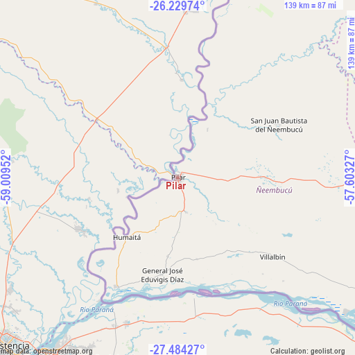
Pilar GPS coordinates[2]
26° 51' 31.464" South, 58° 18' 23.004" West
| Map corner | latitude | longitude |
|---|---|---|
| Upper-left | -26.22974°, | -59.00952° |
| Center: | -26.85874°, | -58.30639° |
| Lower-right: | -27.48427°, | -57.60327° |
| Map W x H: | 139.5×139.5 km | = 86.7×86.7mi |
| max Lat: | -19.91667° ⇑85.2% North |
| Pilar: | -26.85874° |
| min Lat: | ⇓14.8% South -27.38662° |
| min Long | Pilar | max Long |
| -60.78333° | -58.30639° | -54.30694° |
| W 3.7%⇐ | ⇒96.3% E |
Elevation
Elevation of Pilar is 55 m = 180 ft, and this is 114.7 m = 376 ft below average elevation for this country.
| Max E: |
658 m = 2159 ft | 99.4% |
| Avg. | 169.7 m = 557 ft | |
| Pilar | 55 m = 180 ft | |
Min E: |
46 m = 151 ft | 0.6% |
See also: Paraguay elevation on elevation.city.
Geographical zone
Pilar is located in South temperate zone (between Tropic of Capricorn and the Antarctic Circle). Distance of this Southern Tropic circle is 380.5 km =236.4 mi to North.| Distance of | km | miles | from Pilar |
|---|---|---|---|
| Equator | 2986.4 | 1855.7 | to North |
| Tropic Capricorn | 380.5 | 236.4 | to North |
| Antarctic Circle | 4414.8 | 2743.2 | to South |
| South Pole | 7020.6 | 4362.4 | to South |


Nearby cities:
15 places around Pilar: (largest is in red/bold)
• Caapucú
131.6 km =81.8 mi,  58°
58°
• Cerrito
85 km =52.8 mi,  129°
129°
• General José Eduvigis Díaz
38.6 km =24 mi,  189°
189°
• Laureles
94.5 km =58.7 mi,  117°
117°
• Paso de Patria
48.8 km =30.3 mi,  208°
208°
• Quiindy
145.1 km =90.2 mi,  47°
47°
• Quyquyó
148.8 km =92.5 mi, 62°
• San Juan Bautista
117.1 km =72.8 mi,  79°
79°
• San Miguel
131 km =81.4 mi,  72°
72°
• San Patricio
148.2 km =92.1 mi,  94°
94°
• Santa María
136.5 km =84.8 mi, 86°
• Santa Rosa Misiones
144.6 km =89.9 mi, 91°
• Santiago
155.6 km =96.7 mi,  101°
101°
• Villa Florida
126.5 km =78.6 mi, 65°
• Villa Oliva
103.9 km =64.6 mi,  25°
25°
Sources, notices
• [Note1] Compared only with cities in Paraguay existing in our database
• [Src1] Map data: © OpenStreetMap contributors (CC-BY-SA)
• [Src2] Other city data from geonames.org with taken over terms of usage.
• [Src3] Geographical zone / Annual Mean Temperature by Robert A. Rohde @ Wikipedia
