San Juan Bautista geodata
San Juan Bautista (Misiones) is a seat of a first-order administrative division; located in Paraguay in America/Asuncion (GMT-4) time zone. With population of 16,593 people, there are 24 cities with bigger population in this country. Compared to other cities in Paraguay, 82.1% of cities are located further ↑North; 70.4% of cities are located further →East and 61.1% of cities have higher elevation than San Juan Bautista. Note1


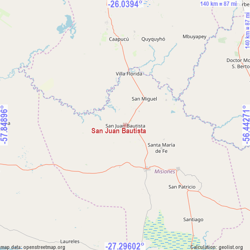
San Juan Bautista GPS coordinates[2]
26° 40' 9.984" South, 57° 8' 44.988" West
| Map corner | latitude | longitude |
|---|---|---|
| Upper-left | -26.0394°, | -57.84896° |
| Center: | -26.66944°, | -57.14583° |
| Lower-right: | -27.29602°, | -56.44271° |
| Map W x H: | 139.7×139.7 km | = 86.8×86.8mi |
| max Lat: | -19.91667° ⇑82.1% North |
| San Juan Bautista: | -26.66944° |
| min Lat: | ⇓17.9% South -27.38662° |
| min Long | San Juan Bautis | max Long |
| -60.78333° | -57.14583° | -54.30694° |
| W 29.6%⇐ | ⇒70.4% E |
Elevation
Elevation of San Juan Bautista is 128 m = 420 ft, and this is 41.7 m = 137 ft below average elevation for this country.
| Max E: |
658 m = 2159 ft | 61.1% |
| Avg. | 169.7 m = 557 ft | |
| San Juan Bautista | 128 m = 420 ft | |
Min E: |
46 m = 151 ft | 38.9% |
See also: Paraguay elevation on elevation.city.
Geographical zone
San Juan Bautista is located in South temperate zone (between Tropic of Capricorn and the Antarctic Circle). Distance of this Southern Tropic circle is 359.4 km =223.3 mi to North.| Distance of | km | miles | from San Juan Bautista |
|---|---|---|---|
| Equator | 2965.4 | 1842.6 | to North |
| Tropic Capricorn | 359.4 | 223.3 | to North |
| Antarctic Circle | 4435.8 | 2756.3 | to South |
| South Pole | 7041.7 | 4375.5 | to South |


Nearby cities:
15 places around San Juan Bautista: (largest is in red/bold)
• Acahay
83.7 km =52 mi,  359°
359°
• Caapucú
48.4 km =30.1 mi, 355°
• General Delgado
77.4 km =48.1 mi,  127°
127°
• Laureles
71.9 km =44.7 mi,  205°
205°
• Mbuyapey
63.2 km =39.3 mi,  37°
37°
• Quiindy
77.6 km =48.2 mi,  353°
353°
• Quyquyó
51.1 km =31.8 mi,  18°
18°
• San Miguel
21.1 km =13.1 mi,  26°
26°
• San Patricio
46.5 km =28.9 mi,  135°
135°
• Santa María
24.6 km =15.3 mi,  120°
120°
• Santa Rosa Misiones
38.1 km =23.7 mi, 129°
• Santiago
64.6 km =40.1 mi, 144°
• Villa Florida
31.8 km =19.8 mi, 359°
• Ybycuí
73.2 km =45.5 mi,  7°
7°
• Yegros
78.1 km =48.5 mi,  71°
71°
Sources, notices
• [Note1] Compared only with cities in Paraguay existing in our database
• [Src1] Map data: © OpenStreetMap contributors (CC-BY-SA)
• [Src2] Other city data from geonames.org with taken over terms of usage.
• [Src3] Geographical zone / Annual Mean Temperature by Robert A. Rohde @ Wikipedia
