Sector 2 geodata
Sector 2 (Bucureşti) is a section of populated place; located in Romania in Europe/Bucharest (GMT+3) time zone. With population of 345,370 people, there are 3 cities with bigger population in this country. Compared to other cities in Romania, 86.5% of cities are located further ↑North; 65.6% of cities are located further ←West and 84.4% of cities have higher elevation than Sector 2. Note1


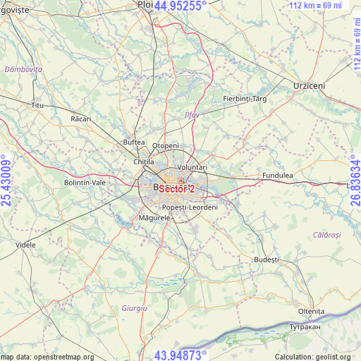
Sector 2 GPS coordinates[2]
44° 27' 10.08" North, 26° 7' 59.556" East
| Map corner | latitude | longitude |
|---|---|---|
| Upper-left | 44.95255°, | 25.43009° |
| Center: | 44.4528°, | 26.13321° |
| Lower-right: | 43.94873°, | 26.83634° |
| Map W x H: | 111.6×111.6 km | = 69.3×69.3mi |
| max Lat: | 48.23793° ⇑86.5% North |
| Sector 2: | 44.4528° |
| min Lat: | ⇓13.5% South 43.65638° |
| min Long | Sector 2 | max Long |
| 20.31667° | 26.13321° | 29.65403° |
| W 65.6%⇐ | ⇒34.4% E |
Elevation
Elevation of Sector 2 is 80 m = 262 ft, and this is 174.9 m = 574 ft below average elevation for this country.
| Max E: |
1278 m = 4193 ft | 84.4% |
| Avg. | 254.9 m = 836 ft | |
| Sector 2 | 80 m = 262 ft | |
Min E: |
-2 m = -7 ft | 15.6% |
See also: Sector 2 elevation on elevation.city.
Geographical zone
Sector 2 is located in North temperate zone (between Tropic of Cancer and the Arctic Circle). Distance of this Northern Tropic circle is 2336.8 km =1452 mi to South.| Distance of | km | miles | from Sector 2 |
|---|---|---|---|
| North Pole | 5064.4 | 3146.9 | to North |
| Arctic Circle | 2458.5 | 1527.6 | to North |
| Tropic Cancer | 2336.8 | 1452 | to South |
| Equator | 4942.7 | 3071.3 | to South |


Nearby cities:
15 places around Sector 2: (largest is in red/bold)
• Bucharest
3.1 km =1.9 mi,  223°
223°
• Bucuresti
4 km =2.5 mi,  226°
226°
• Cățelu
8.8 km =5.5 mi,  128°
128°
• Dobroeşti
4 km =2.5 mi,  94°
94°
• Fundeni
2.7 km =1.7 mi,  75°
75°
• Pantelimon
5.3 km =3.3 mi, 93°
• Popeşti-Leordeni
8.2 km =5.1 mi,  161°
161°
• Roșu
9.7 km =6 mi,  268°
268°
• Sector 1
8 km =5 mi,  303°
303°
• Sector 3
4.3 km =2.7 mi,  139°
139°
• Sector 4
8.6 km =5.3 mi,  186°
186°
• Sector 5
8.7 km =5.4 mi,  214°
214°
• Sector 6
9.5 km =5.9 mi,  258°
258°
• Voluntari
5.2 km =3.2 mi,  37°
37°
• Ştefăneştii de Jos
10.4 km =6.5 mi,  30°
30°
Sources, notices
• [Note1] Compared only with cities in Romania existing in our database
• [Src1] Map data: © OpenStreetMap contributors (CC-BY-SA)
• [Src2] Other city data from geonames.org with taken over terms of usage.
• [Src3] Geographical zone / Annual Mean Temperature by Robert A. Rohde @ Wikipedia
