Sector 6 geodata
Sector 6 (Bucureşti) is a section of populated place; located in Romania in Europe/Bucharest (GMT+3) time zone. With population of 367,760 people, there are 2 cities with bigger population in this country. Compared to other cities in Romania, 87.1% of cities are located further ↑North; 63.2% of cities are located further ←West and 79.9% of cities have higher elevation than Sector 6. Note1


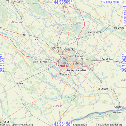
Sector 6 GPS coordinates[2]
44° 26' 8.844" North, 26° 0' 59.364" East
| Map corner | latitude | longitude |
|---|---|---|
| Upper-left | 44.93569°, | 25.31337° |
| Center: | 44.43579°, | 26.01649° |
| Lower-right: | 43.93158°, | 26.71962° |
| Map W x H: | 111.6×111.6 km | = 69.3×69.3mi |
| max Lat: | 48.23793° ⇑87.1% North |
| Sector 6: | 44.43579° |
| min Lat: | ⇓12.9% South 43.65638° |
| min Long | Sector 6 | max Long |
| 20.31667° | 26.01649° | 29.65403° |
| W 63.2%⇐ | ⇒36.8% E |
Elevation
Elevation of Sector 6 is 95 m = 312 ft, and this is 159.9 m = 525 ft below average elevation for this country.
| Max E: |
1278 m = 4193 ft | 79.9% |
| Avg. | 254.9 m = 836 ft | |
| Sector 6 | 95 m = 312 ft | |
Min E: |
-2 m = -7 ft | 20.1% |
See also: Sector 6 elevation on elevation.city.
Geographical zone
Sector 6 is located in North temperate zone (between Tropic of Cancer and the Arctic Circle). Distance of this Northern Tropic circle is 2334.9 km =1450.8 mi to South.| Distance of | km | miles | from Sector 6 |
|---|---|---|---|
| North Pole | 5066.3 | 3148.1 | to North |
| Arctic Circle | 2460.4 | 1528.8 | to North |
| Tropic Cancer | 2334.9 | 1450.8 | to South |
| Equator | 4940.8 | 3070.1 | to South |


Nearby cities:
15 places around Sector 6: (largest is in red/bold)
• Bragadiru
7.8 km =4.8 mi,  203°
203°
• Bucharest
7.1 km =4.4 mi,  93°
93°
• Bucuresti
6.4 km =4 mi,  97°
97°
• Chiajna
4.4 km =2.7 mi,  308°
308°
• Chitila
8.5 km =5.3 mi,  341°
341°
• Clinceni
8.5 km =5.3 mi,  215°
215°
• Domnești
8.9 km =5.5 mi,  242°
242°
• Dragomireşti-Vale
7.8 km =4.8 mi,  303°
303°
• Dragomirești-Deal
6.4 km =4 mi, 297°
• Dudu
3.1 km =1.9 mi,  317°
317°
• Olteni
7.1 km =4.4 mi,  227°
227°
• Roșu
1.7 km =1.1 mi,  345°
345°
• Rudeni
5.3 km =3.3 mi, 319°
• Sector 1
6.8 km =4.2 mi,  21°
21°
• Sector 5
6.9 km =4.3 mi,  140°
140°
Sources, notices
• [Note1] Compared only with cities in Romania existing in our database
• [Src1] Map data: © OpenStreetMap contributors (CC-BY-SA)
• [Src2] Other city data from geonames.org with taken over terms of usage.
• [Src3] Geographical zone / Annual Mean Temperature by Robert A. Rohde @ Wikipedia
