Zorile geodata
Zorile (Giurgiu) is a populated place; located in Romania in Europe/Bucharest (GMT+3) time zone. With population of 1,092 people, there are 4011 cities with bigger population in this country. Compared to other cities in Romania, 88.8% of cities are located further ↑North; 59.3% of cities are located further ←West and 79.6% of cities have higher elevation than Zorile. Note1


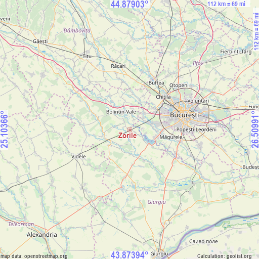
Zorile GPS coordinates[2]
44° 22' 43.104" North, 25° 48' 24.408" East
| Map corner | latitude | longitude |
|---|---|---|
| Upper-left | 44.87903°, | 25.10366° |
| Center: | 44.37864°, | 25.80678° |
| Lower-right: | 43.87394°, | 26.50991° |
| Map W x H: | 111.8×111.8 km | = 69.5×69.5mi |
| max Lat: | 48.23793° ⇑88.8% North |
| Zorile: | 44.37864° |
| min Lat: | ⇓11.2% South 43.65638° |
| min Long | Zorile | max Long |
| 20.31667° | 25.80678° | 29.65403° |
| W 59.3%⇐ | ⇒40.7% E |
Elevation
Elevation of Zorile is 96 m = 315 ft, and this is 158.9 m = 521 ft below average elevation for this country.
| Max E: |
1278 m = 4193 ft | 79.6% |
| Avg. | 254.9 m = 836 ft | |
| Zorile | 96 m = 315 ft | |
Min E: |
-2 m = -7 ft | 20.4% |
See also: Romania elevation on elevation.city.
Geographical zone
Zorile is located in North temperate zone (between Tropic of Cancer and the Arctic Circle). Distance of this Northern Tropic circle is 2328.5 km =1446.9 mi to South.| Distance of | km | miles | from Zorile |
|---|---|---|---|
| North Pole | 5072.6 | 3152 | to North |
| Arctic Circle | 2466.7 | 1532.7 | to North |
| Tropic Cancer | 2328.5 | 1446.9 | to South |
| Equator | 4934.4 | 3066.1 | to South |


Nearby cities:
15 places around Zorile: (largest is in red/bold)
• Bolintin Deal
9 km =5.6 mi,  7°
7°
• Bolintin Vale
8.7 km =5.4 mi,  333°
333°
• Buturugeni
2.7 km =1.7 mi,  123°
123°
• Crivina
6.1 km =3.8 mi,  344°
344°
• Domneşti-Sârbi
8.7 km =5.4 mi,  86°
86°
• Dârvari
7.5 km =4.7 mi,  50°
50°
• Grădinari
1.7 km =1.1 mi,  24°
24°
• Hobaia
2.7 km =1.7 mi,  296°
296°
• Mihai Vodă
6.8 km =4.2 mi, 8°
• Neajlovu
8.2 km =5.1 mi,  210°
210°
• Ogrezeni
5.5 km =3.4 mi, 326°
• Podișor
7.5 km =4.7 mi,  280°
280°
• Pădureni
3.7 km =2.3 mi,  182°
182°
• Tântava
4.3 km =2.7 mi, 19°
• Țegheș
5.3 km =3.3 mi, 86°
Sources, notices
• [Note1] Compared only with cities in Romania existing in our database
• [Src1] Map data: © OpenStreetMap contributors (CC-BY-SA)
• [Src2] Other city data from geonames.org with taken over terms of usage.
• [Src3] Geographical zone / Annual Mean Temperature by Robert A. Rohde @ Wikipedia
