Neajlovu geodata
Neajlovu (Giurgiu) is a populated place; located in Romania in Europe/Bucharest (GMT+3) time zone. With population of 718 people, there are 5471 cities with bigger population in this country. Compared to other cities in Romania, 90.5% of cities are located further ↑North; 58.2% of cities are located further ←West and 83.5% of cities have higher elevation than Neajlovu. Note1


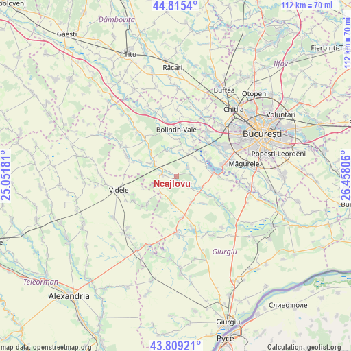
Neajlovu GPS coordinates[2]
44° 18' 52.056" North, 25° 45' 17.748" East
| Map corner | latitude | longitude |
|---|---|---|
| Upper-left | 44.8154°, | 25.05181° |
| Center: | 44.31446°, | 25.75493° |
| Lower-right: | 43.80921°, | 26.45806° |
| Map W x H: | 111.9×111.9 km | = 69.5×69.5mi |
| max Lat: | 48.23793° ⇑90.5% North |
| Neajlovu: | 44.31446° |
| min Lat: | ⇓9.5% South 43.65638° |
| min Long | Neajlovu | max Long |
| 20.31667° | 25.75493° | 29.65403° |
| W 58.2%⇐ | ⇒41.8% E |
Elevation
Elevation of Neajlovu is 83 m = 272 ft, and this is 171.9 m = 564 ft below average elevation for this country.
| Max E: |
1278 m = 4193 ft | 83.5% |
| Avg. | 254.9 m = 836 ft | |
| Neajlovu | 83 m = 272 ft | |
Min E: |
-2 m = -7 ft | 16.5% |
See also: Romania elevation on elevation.city.
Geographical zone
Neajlovu is located in North temperate zone (between Tropic of Cancer and the Arctic Circle). Distance of this Northern Tropic circle is 2321.4 km =1442.5 mi to South.| Distance of | km | miles | from Neajlovu |
|---|---|---|---|
| North Pole | 5079.8 | 3156.4 | to North |
| Arctic Circle | 2473.9 | 1537.2 | to North |
| Tropic Cancer | 2321.4 | 1442.5 | to South |
| Equator | 4927.3 | 3061.7 | to South |


Nearby cities:
15 places around Neajlovu: (largest is in red/bold)
• Bucşani
10.5 km =6.5 mi,  310°
310°
• Bulbucata
5.2 km =3.2 mi,  131°
131°
• Buturugeni
8.5 km =5.3 mi,  48°
48°
• Clejani
4.5 km =2.8 mi,  277°
277°
• Gorneni
9.5 km =5.9 mi,  112°
112°
• Grădinari
9.9 km =6.2 mi,  29°
29°
• Hobaia
8.5 km =5.3 mi,  11°
11°
• Letca Nouă
8.9 km =5.5 mi,  186°
186°
• Milcovățu
7 km =4.3 mi,  219°
219°
• Podișor
9 km =5.6 mi,  339°
339°
• Podu Doamnei
1 km =0.6 mi,  226°
226°
• Pădureni
5.3 km =3.3 mi, 48°
• Vadu Lat
7.1 km =4.4 mi,  298°
298°
• Valea Plopilor
9.8 km =6.1 mi,  148°
148°
• Zorile
8.2 km =5.1 mi, 30°
Sources, notices
• [Note1] Compared only with cities in Romania existing in our database
• [Src1] Map data: © OpenStreetMap contributors (CC-BY-SA)
• [Src2] Other city data from geonames.org with taken over terms of usage.
• [Src3] Geographical zone / Annual Mean Temperature by Robert A. Rohde @ Wikipedia
