Vitănești geodata
Vitănești (Vrancea) is a populated place; located in Romania in Europe/Bucharest (GMT+3) time zone. With population of 727 people, there are 5418 cities with bigger population in this country. Compared to other cities in Romania, 52.3% of cities are located further ↓South; 83.6% of cities are located further ←West and 56.6% of cities have higher elevation than Vitănești. Note1


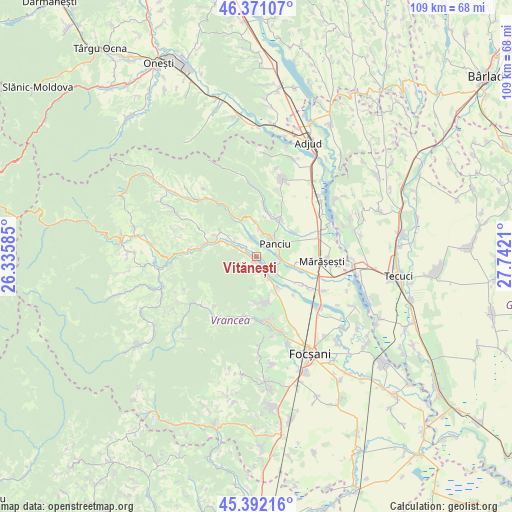
Vitănești GPS coordinates[2]
45° 53' 1.572" North, 27° 2' 20.292" East
| Map corner | latitude | longitude |
|---|---|---|
| Upper-left | 46.37107°, | 26.33585° |
| Center: | 45.88377°, | 27.03897° |
| Lower-right: | 45.39216°, | 27.7421° |
| Map W x H: | 108.8×108.8 km | = 67.6×67.6mi |
| max Lat: | 48.23793° ⇑47.7% North |
| Vitănești: | 45.88377° |
| min Lat: | ⇓52.3% South 43.65638° |
| min Long | Vitănești | max Long |
| 20.31667° | 27.03897° | 29.65403° |
| W 83.6%⇐ | ⇒16.4% E |
Elevation
Elevation of Vitănești is 180 m = 591 ft, and this is 74.9 m = 246 ft below average elevation for this country.
| Max E: |
1278 m = 4193 ft | 56.6% |
| Avg. | 254.9 m = 836 ft | |
| Vitănești | 180 m = 591 ft | |
Min E: |
-2 m = -7 ft | 43.4% |
See also: Romania elevation on elevation.city.
Geographical zone
Vitănești is located in North temperate zone (between Tropic of Cancer and the Arctic Circle). Distance of this North polar circle is 2299.4 km =1428.8 mi to North.| Distance of | km | miles | from Vitănești |
|---|---|---|---|
| North Pole | 4905.3 | 3048 | to North |
| Arctic Circle | 2299.4 | 1428.8 | to North |
| Tropic Cancer | 2495.9 | 1550.9 | to South |
| Equator | 5101.8 | 3170.1 | to South |


Nearby cities:
15 places around Vitănești: (largest is in red/bold)
• Boloteşti
6 km =3.7 mi,  159°
159°
• Burca
7.6 km =4.7 mi,  294°
294°
• Crucea de Sus
5.1 km =3.2 mi,  42°
42°
• Dumbrava
6.4 km =4 mi,  63°
63°
• Găgești
3.3 km =2.1 mi, 157°
• Neicu
4.6 km =2.9 mi, 37°
• Oleșești
6.2 km =3.9 mi,  129°
129°
• Panciu
3.9 km =2.4 mi, 62°
• Pietroasa
2.1 km =1.3 mi,  175°
175°
• Satu Nou
4.6 km =2.9 mi,  82°
82°
• Străoane
5.6 km =3.5 mi,  8°
8°
• Sârbi
2.6 km =1.6 mi, 127°
• Vităneștii de Sub Măgură
1.4 km =0.9 mi,  221°
221°
• Ţifeşti
6 km =3.7 mi, 128°
• Șerbești
6.8 km =4.2 mi,  309°
309°
Sources, notices
• [Note1] Compared only with cities in Romania existing in our database
• [Src1] Map data: © OpenStreetMap contributors (CC-BY-SA)
• [Src2] Other city data from geonames.org with taken over terms of usage.
• [Src3] Geographical zone / Annual Mean Temperature by Robert A. Rohde @ Wikipedia
