Străoane geodata
Străoane (Vrancea) is a seat of a second-order administrative division; located in Romania in Europe/Bucharest (GMT+3) time zone. With population of 4,049 people, there are 1143 cities with bigger population in this country. Compared to other cities in Romania, 53.6% of cities are located further ↓South; 83.8% of cities are located further ←West and 70.7% of cities have lower elevation than Străoane. Note1


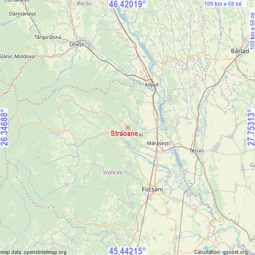
Străoane GPS coordinates[2]
45° 55' 59.988" North, 27° 3' 0" East
| Map corner | latitude | longitude |
|---|---|---|
| Upper-left | 46.42019°, | 26.34688° |
| Center: | 45.93333°, | 27.05° |
| Lower-right: | 45.44215°, | 27.75313° |
| Map W x H: | 108.7×108.7 km | = 67.5×67.5mi |
| max Lat: | 48.23793° ⇑46.4% North |
| Străoane: | 45.93333° |
| min Lat: | ⇓53.6% South 43.65638° |
| min Long | Străoane | max Long |
| 20.31667° | 27.05° | 29.65403° |
| W 83.8%⇐ | ⇒16.2% E |
Elevation
Elevation of Străoane is 326 m = 1070 ft, and this is 71.1 m = 233 ft above average elevation for this country.
| Max E: |
1278 m = 4193 ft | 29.3% |
| Străoane | 326 m 1070 ft | |
| Avg. | 254.9 m = 836 ft | |
Min E: |
-2 m = -7 ft | 70.7% |
See also: Romania elevation on elevation.city.
Geographical zone
Străoane is located in North temperate zone (between Tropic of Cancer and the Arctic Circle). Distance of this North polar circle is 2293.9 km =1425.4 mi to North.| Distance of | km | miles | from Străoane |
|---|---|---|---|
| North Pole | 4899.8 | 3044.6 | to North |
| Arctic Circle | 2293.9 | 1425.4 | to North |
| Tropic Cancer | 2501.4 | 1554.3 | to South |
| Equator | 5107.3 | 3173.5 | to South |


Nearby cities:
15 places around Străoane: (largest is in red/bold)
• Crucea de Sus
3.1 km =1.9 mi,  124°
124°
• Diocheți-Rediu
6.9 km =4.3 mi,  92°
92°
• Dumbrava
5.6 km =3.5 mi, 118°
• Fitioneşti
5.6 km =3.5 mi,  0°
0°
• Moviliţa
4.3 km =2.7 mi,  64°
64°
• Muncelu
2.5 km =1.6 mi,  324°
324°
• Neicu
2.7 km =1.7 mi,  133°
133°
• Panciu
4.5 km =2.8 mi,  145°
145°
• Pietroasa
7.6 km =4.7 mi,  185°
185°
• Satu Nou
6.1 km =3.8 mi,  142°
142°
• Sârbi
7.2 km =4.5 mi,  170°
170°
• Varnița
7.9 km =4.9 mi,  302°
302°
• Vitănești
5.6 km =3.5 mi, 188°
• Vităneștii de Sub Măgură
6.8 km =4.2 mi,  195°
195°
• Șerbești
6.2 km =3.9 mi,  259°
259°
Sources, notices
• [Note1] Compared only with cities in Romania existing in our database
• [Src1] Map data: © OpenStreetMap contributors (CC-BY-SA)
• [Src2] Other city data from geonames.org with taken over terms of usage.
• [Src3] Geographical zone / Annual Mean Temperature by Robert A. Rohde @ Wikipedia
