Vermeș geodata
Vermeș (Bistriţa-Năsăud) is a populated place; located in Romania in Europe/Bucharest (GMT+3) time zone. With population of 897 people, there are 4630 cities with bigger population in this country. Compared to other cities in Romania, 79% of cities are located further ↓South; 63.5% of cities are located further →East and 73.4% of cities have lower elevation than Vermeș. Note1


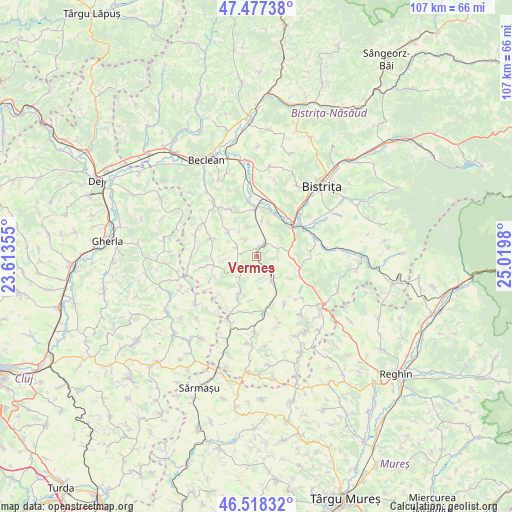
Vermeș GPS coordinates[2]
47° 0' 0" North, 24° 19' 0.012" East
| Map corner | latitude | longitude |
|---|---|---|
| Upper-left | 47.47738°, | 23.61355° |
| Center: | 47°, | 24.31667° |
| Lower-right: | 46.51832°, | 25.0198° |
| Map W x H: | 106.6×106.6 km | = 66.2×66.2mi |
| max Lat: | 48.23793° ⇑21% North |
| Vermeș: | 47° |
| min Lat: | ⇓79% South 43.65638° |
| min Long | Vermeș | max Long |
| 20.31667° | 24.31667° | 29.65403° |
| W 36.5%⇐ | ⇒63.5% E |
Elevation
Elevation of Vermeș is 342 m = 1122 ft, and this is 87.1 m = 286 ft above average elevation for this country.
| Max E: |
1278 m = 4193 ft | 26.6% |
| Vermeș | 342 m 1122 ft | |
| Avg. | 254.9 m = 836 ft | |
Min E: |
-2 m = -7 ft | 73.4% |
See also: Romania elevation on elevation.city.
Geographical zone
Vermeș is located in North temperate zone (between Tropic of Cancer and the Arctic Circle). Distance of this North polar circle is 2175.3 km =1351.7 mi to North.| Distance of | km | miles | from Vermeș |
|---|---|---|---|
| North Pole | 4781.2 | 2970.9 | to North |
| Arctic Circle | 2175.3 | 1351.7 | to North |
| Tropic Cancer | 2620 | 1628 | to South |
| Equator | 5225.9 | 3247.2 | to South |


Nearby cities:
15 places around Vermeș: (largest is in red/bold)
• Arcalia
9.7 km =6 mi,  22°
22°
• Bozieș
10.2 km =6.3 mi,  291°
291°
• Chintelnic
11.4 km =7.1 mi,  7°
7°
• Chiochiş
10.3 km =6.4 mi,  259°
259°
• Chiraleș
9.8 km =6.1 mi,  359°
359°
• Corvinești
4.7 km =2.9 mi, 293°
• Crainimăt
10.2 km =6.3 mi,  39°
39°
• Dipșa
10.2 km =6.3 mi,  114°
114°
• Frunzi
11.2 km =7 mi,  173°
173°
• Fântânele
7.3 km =4.5 mi,  206°
206°
• Galaţii Bistriţei
6.6 km =4.1 mi, 106°
• Lechinţa
3.1 km =1.9 mi,  53°
53°
• Matei
4.2 km =2.6 mi,  243°
243°
• Sângeorzu Nou
5.3 km =3.3 mi,  134°
134°
• Şieu-Măgheruş
10.6 km =6.6 mi,  28°
28°
Sources, notices
• [Note1] Compared only with cities in Romania existing in our database
• [Src1] Map data: © OpenStreetMap contributors (CC-BY-SA)
• [Src2] Other city data from geonames.org with taken over terms of usage.
• [Src3] Geographical zone / Annual Mean Temperature by Robert A. Rohde @ Wikipedia
