Chiraleș geodata
Chiraleș (Bistriţa-Năsăud) is a populated place; located in Romania in Europe/Bucharest (GMT+3) time zone. With population of 517 people, there are 6889 cities with bigger population in this country. Compared to other cities in Romania, 81.2% of cities are located further ↓South; 63.5% of cities are located further →East and 64.7% of cities have lower elevation than Chiraleș. Note1


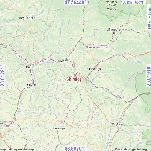
Chiraleș GPS coordinates[2]
47° 5' 16.44" North, 24° 18' 57.708" East
| Map corner | latitude | longitude |
|---|---|---|
| Upper-left | 47.56449°, | 23.61291° |
| Center: | 47.0879°, | 24.31603° |
| Lower-right: | 46.60701°, | 25.01916° |
| Map W x H: | 106.5×106.5 km | = 66.2×66.2mi |
| max Lat: | 48.23793° ⇑18.8% North |
| Chiraleș: | 47.0879° |
| min Lat: | ⇓81.2% South 43.65638° |
| min Long | Chiraleș | max Long |
| 20.31667° | 24.31603° | 29.65403° |
| W 36.5%⇐ | ⇒63.5% E |
Elevation
Elevation of Chiraleș is 288 m = 945 ft, and this is 33.1 m = 109 ft above average elevation for this country.
| Max E: |
1278 m = 4193 ft | 35.3% |
| Chiraleș | 288 m 945 ft | |
| Avg. | 254.9 m = 836 ft | |
Min E: |
-2 m = -7 ft | 64.7% |
See also: Romania elevation on elevation.city.
Geographical zone
Chiraleș is located in North temperate zone (between Tropic of Cancer and the Arctic Circle). Distance of this North polar circle is 2165.5 km =1345.6 mi to North.| Distance of | km | miles | from Chiraleș |
|---|---|---|---|
| North Pole | 4771.4 | 2964.8 | to North |
| Arctic Circle | 2165.5 | 1345.6 | to North |
| Tropic Cancer | 2629.8 | 1634.1 | to South |
| Equator | 5235.7 | 3253.3 | to South |


Nearby cities:
15 places around Chiraleș: (largest is in red/bold)
• Arcalia
3.8 km =2.4 mi,  101°
101°
• Beudiu
11.2 km =7 mi,  255°
255°
• Bozieș
11.2 km =7 mi,  237°
237°
• Chintelnic
2.2 km =1.4 mi,  47°
47°
• Corvinești
8.9 km =5.5 mi,  208°
208°
• Crainimăt
6.7 km =4.2 mi,  106°
106°
• Lechinţa
8.3 km =5.2 mi,  161°
161°
• Nuşeni
8.9 km =5.5 mi,  278°
278°
• Sigmir
9.9 km =6.2 mi,  58°
58°
• Sărata
9.2 km =5.7 mi, 100°
• Vermeș
9.8 km =6.1 mi,  179°
179°
• Viișoara
10.2 km =6.3 mi,  80°
80°
• Şieu-Măgheruş
5.1 km =3.2 mi, 95°
• Şieu-Odorhei
7.4 km =4.6 mi,  345°
345°
• Şintereag
10.7 km =6.6 mi, 353°
Sources, notices
• [Note1] Compared only with cities in Romania existing in our database
• [Src1] Map data: © OpenStreetMap contributors (CC-BY-SA)
• [Src2] Other city data from geonames.org with taken over terms of usage.
• [Src3] Geographical zone / Annual Mean Temperature by Robert A. Rohde @ Wikipedia
