Fântânele geodata
Fântânele (Bistriţa-Năsăud) is a populated place; located in Romania in Europe/Bucharest (GMT+3) time zone. With population of 680 people, there are 5689 cities with bigger population in this country. Compared to other cities in Romania, 77.6% of cities are located further ↓South; 64.4% of cities are located further →East and 78.9% of cities have lower elevation than Fântânele. Note1


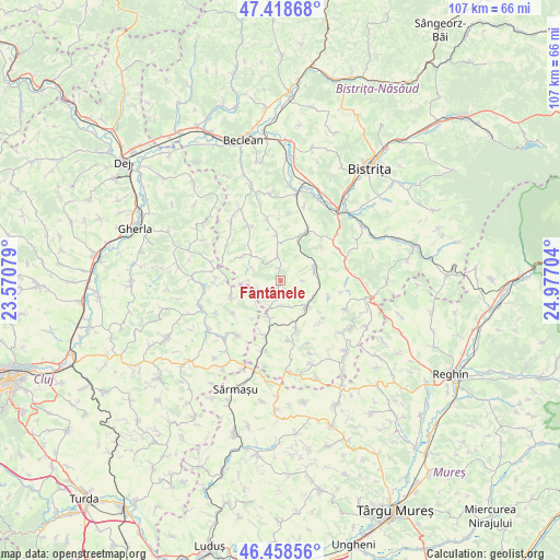
Fântânele GPS coordinates[2]
46° 56' 26.772" North, 24° 16' 26.076" East
| Map corner | latitude | longitude |
|---|---|---|
| Upper-left | 47.41868°, | 23.57079° |
| Center: | 46.94077°, | 24.27391° |
| Lower-right: | 46.45856°, | 24.97704° |
| Map W x H: | 106.8×106.8 km | = 66.4×66.4mi |
| max Lat: | 48.23793° ⇑22.4% North |
| Fântânele: | 46.94077° |
| min Lat: | ⇓77.6% South 43.65638° |
| min Long | Fântânele | max Long |
| 20.31667° | 24.27391° | 29.65403° |
| W 35.6%⇐ | ⇒64.4% E |
Elevation
Elevation of Fântânele is 383 m = 1257 ft, and this is 128.1 m = 420 ft above average elevation for this country.
| Max E: |
1278 m = 4193 ft | 21.1% |
| Fântânele | 383 m 1257 ft | |
| Avg. | 254.9 m = 836 ft | |
Min E: |
-2 m = -7 ft | 78.9% |
See also: Romania elevation on elevation.city.
Geographical zone
Fântânele is located in North temperate zone (between Tropic of Cancer and the Arctic Circle). Distance of this North polar circle is 2181.8 km =1355.7 mi to North.| Distance of | km | miles | from Fântânele |
|---|---|---|---|
| North Pole | 4787.7 | 2974.9 | to North |
| Arctic Circle | 2181.8 | 1355.7 | to North |
| Tropic Cancer | 2613.4 | 1623.9 | to South |
| Equator | 5219.3 | 3243.1 | to South |


Nearby cities:
15 places around Fântânele: (largest is in red/bold)
• Budeşti
6.6 km =4.1 mi,  195°
195°
• Buza
10.4 km =6.5 mi,  244°
244°
• Chiochiş
8.3 km =5.2 mi,  304°
304°
• Corvinești
8.6 km =5.3 mi,  352°
352°
• Feldioara
11 km =6.8 mi, 235°
• Frunzi
6.4 km =4 mi,  135°
135°
• Galaţii Bistriţei
10.7 km =6.6 mi,  63°
63°
• Jimbor
5.2 km =3.2 mi,  251°
251°
• Lechinţa
10.2 km =6.3 mi,  34°
34°
• Matei
4.8 km =3 mi, 353°
• Miceştii de Câmpie
8.9 km =5.5 mi,  158°
158°
• Sângeorzu Nou
7.6 km =4.7 mi,  67°
67°
• Sânmihaiu de Câmpie
7.1 km =4.4 mi, 138°
• Vermeș
7.3 km =4.5 mi, 26°
• Visuia
11.6 km =7.2 mi,  172°
172°
Sources, notices
• [Note1] Compared only with cities in Romania existing in our database
• [Src1] Map data: © OpenStreetMap contributors (CC-BY-SA)
• [Src2] Other city data from geonames.org with taken over terms of usage.
• [Src3] Geographical zone / Annual Mean Temperature by Robert A. Rohde @ Wikipedia
