Utvin geodata
Utvin (Timiş) is a populated place; located in Romania in Europe/Bucharest (GMT+3) time zone. With population of 1,672 people, there are 2956 cities with bigger population in this country. Compared to other cities in Romania, 51.7% of cities are located further ↑North; 98.9% of cities are located further →East and 83.1% of cities have higher elevation than Utvin. Note1


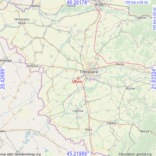
Utvin GPS coordinates[2]
45° 42' 46.728" North, 21° 7' 48.396" East
| Map corner | latitude | longitude |
|---|---|---|
| Upper-left | 46.20178°, | 20.42699° |
| Center: | 45.71298°, | 21.13011° |
| Lower-right: | 45.21986°, | 21.83324° |
| Map W x H: | 109.2×109.2 km | = 67.9×67.9mi |
| max Lat: | 48.23793° ⇑51.7% North |
| Utvin: | 45.71298° |
| min Lat: | ⇓48.3% South 43.65638° |
| min Long | Utvin | max Long |
| 20.31667° | 21.13011° | 29.65403° |
| W 1.1%⇐ | ⇒98.9% E |
Elevation
Elevation of Utvin is 84 m = 276 ft, and this is 170.9 m = 561 ft below average elevation for this country.
| Max E: |
1278 m = 4193 ft | 83.1% |
| Avg. | 254.9 m = 836 ft | |
| Utvin | 84 m = 276 ft | |
Min E: |
-2 m = -7 ft | 16.9% |
See also: Romania elevation on elevation.city.
Geographical zone
Utvin is located in North temperate zone (between Tropic of Cancer and the Arctic Circle). Distance of this North polar circle is 2318.4 km =1440.6 mi to North.| Distance of | km | miles | from Utvin |
|---|---|---|---|
| North Pole | 4924.3 | 3059.8 | to North |
| Arctic Circle | 2318.4 | 1440.6 | to North |
| Tropic Cancer | 2476.9 | 1539.1 | to South |
| Equator | 5082.8 | 3158.3 | to South |


Nearby cities:
15 places around Utvin: (largest is in red/bold)
• Beregsău Mare
9.5 km =5.9 mi,  302°
302°
• Beregsău Mic
12.5 km =7.8 mi,  289°
289°
• Chișoda
6.6 km =4.1 mi,  98°
98°
• Diniaș
11.9 km =7.4 mi,  234°
234°
• Dumbrăviţa
12.8 km =8 mi,  43°
43°
• Giroc
8.5 km =5.3 mi, 104°
• Parța
9.4 km =5.8 mi,  175°
175°
• Peciu Nou
13.1 km =8.1 mi,  205°
205°
• Pădureni
14.3 km =8.9 mi,  151°
151°
• Sânmihaiu German
7.7 km =4.8 mi,  268°
268°
• Sânmihaiu Român
3.3 km =2.1 mi,  253°
253°
• Săcălaz
5.2 km =3.2 mi,  344°
344°
• Timişoara
8.7 km =5.4 mi,  58°
58°
• Urseni
14.1 km =8.8 mi, 99°
• Şag
8 km =5 mi, 153°
Sources, notices
• [Note1] Compared only with cities in Romania existing in our database
• [Src1] Map data: © OpenStreetMap contributors (CC-BY-SA)
• [Src2] Other city data from geonames.org with taken over terms of usage.
• [Src3] Geographical zone / Annual Mean Temperature by Robert A. Rohde @ Wikipedia
