Ungheni geodata
Ungheni (Neamţ) is a populated place; located in Romania in Europe/Bucharest (GMT+3) time zone. With population of 571 people, there are 6419 cities with bigger population in this country. Compared to other cities in Romania, 85.8% of cities are located further ↓South; 71.8% of cities are located further ←West and 66.3% of cities have lower elevation than Ungheni. Note1


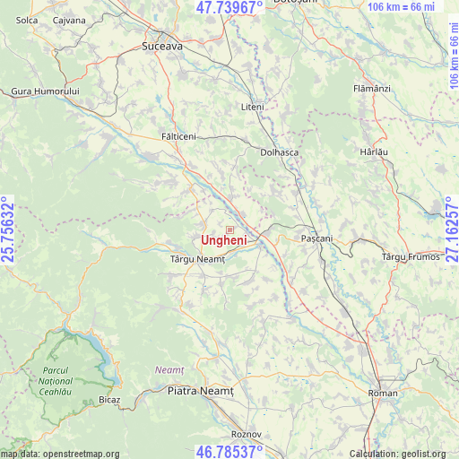
Ungheni GPS coordinates[2]
47° 15' 52.812" North, 26° 27' 33.984" East
| Map corner | latitude | longitude |
|---|---|---|
| Upper-left | 47.73967°, | 25.75632° |
| Center: | 47.26467°, | 26.45944° |
| Lower-right: | 46.78537°, | 27.16257° |
| Map W x H: | 106.1×106.1 km | = 65.9×65.9mi |
| max Lat: | 48.23793° ⇑14.2% North |
| Ungheni: | 47.26467° |
| min Lat: | ⇓85.8% South 43.65638° |
| min Long | Ungheni | max Long |
| 20.31667° | 26.45944° | 29.65403° |
| W 71.8%⇐ | ⇒28.2% E |
Elevation
Elevation of Ungheni is 298 m = 978 ft, and this is 43.1 m = 141 ft above average elevation for this country.
| Max E: |
1278 m = 4193 ft | 33.7% |
| Ungheni | 298 m 978 ft | |
| Avg. | 254.9 m = 836 ft | |
Min E: |
-2 m = -7 ft | 66.3% |
See also: Romania elevation on elevation.city.
Geographical zone
Ungheni is located in North temperate zone (between Tropic of Cancer and the Arctic Circle). Distance of this North polar circle is 2145.8 km =1333.3 mi to North.| Distance of | km | miles | from Ungheni |
|---|---|---|---|
| North Pole | 4751.7 | 2952.6 | to North |
| Arctic Circle | 2145.8 | 1333.3 | to North |
| Tropic Cancer | 2649.4 | 1646.3 | to South |
| Equator | 5255.3 | 3265.5 | to South |


Nearby cities:
15 places around Ungheni: (largest is in red/bold)
• Blebea
8.5 km =5.3 mi,  207°
207°
• Broșteni
8.5 km =5.3 mi,  58°
58°
• Brusturi
6.1 km =3.8 mi,  289°
289°
• Cristeşti
8.1 km =5 mi,  88°
88°
• Drăguşeni
2.7 km =1.7 mi,  40°
40°
• Drăgănești
6.4 km =4 mi,  320°
320°
• Dumbrava
5.4 km =3.4 mi,  177°
177°
• Oglinzi
8.4 km =5.2 mi,  259°
259°
• Oniceni
6.6 km =4.1 mi,  1°
1°
• Plăieșu
4.6 km =2.9 mi,  138°
138°
• Poiana
8.3 km =5.2 mi,  296°
296°
• Preutești
4.3 km =2.7 mi,  102°
102°
• Răuceşti
3.6 km =2.2 mi,  243°
243°
• Timişeşti
7.7 km =4.8 mi,  117°
117°
• Târzia
9.3 km =5.8 mi,  305°
305°
Sources, notices
• [Note1] Compared only with cities in Romania existing in our database
• [Src1] Map data: © OpenStreetMap contributors (CC-BY-SA)
• [Src2] Other city data from geonames.org with taken over terms of usage.
• [Src3] Geographical zone / Annual Mean Temperature by Robert A. Rohde @ Wikipedia
