Târgu-Mureş geodata
Târgu-Mureş (Mureş) is a seat of a first-order administrative division; located in Romania in Europe/Bucharest (GMT+3) time zone. With population of 146,863 people, there are 21 cities with bigger population in this country. Compared to other cities in Romania, 68.1% of cities are located further ↓South; 59.5% of cities are located further →East and 69.8% of cities have lower elevation than Târgu-Mureş. Note1


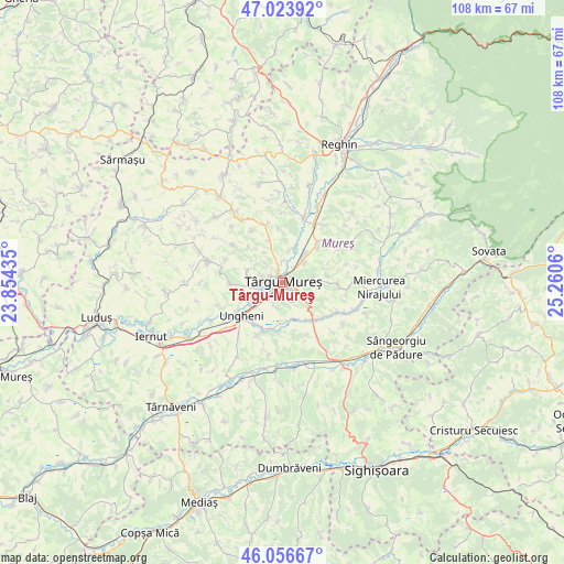
Târgu-Mureş GPS coordinates[2]
46° 32' 32.82" North, 24° 33' 26.892" East
| Map corner | latitude | longitude |
|---|---|---|
| Upper-left | 47.02392°, | 23.85435° |
| Center: | 46.54245°, | 24.55747° |
| Lower-right: | 46.05667°, | 25.2606° |
| Map W x H: | 107.5×107.5 km | = 66.8×66.8mi |
| max Lat: | 48.23793° ⇑31.9% North |
| Târgu-Mureş: | 46.54245° |
| min Lat: | ⇓68.1% South 43.65638° |
| min Long | Târgu-Mureş | max Long |
| 20.31667° | 24.55747° | 29.65403° |
| W 40.5%⇐ | ⇒59.5% E |
Elevation
Elevation of Târgu-Mureş is 319 m = 1047 ft, and this is 64.1 m = 210 ft above average elevation for this country.
| Max E: |
1278 m = 4193 ft | 30.2% |
| Târgu-Mureş | 319 m 1047 ft | |
| Avg. | 254.9 m = 836 ft | |
Min E: |
-2 m = -7 ft | 69.8% |
See also: Târgu-Mureş elevation on elevation.city.
Geographical zone
Târgu-Mureş is located in North temperate zone (between Tropic of Cancer and the Arctic Circle). Distance of this North polar circle is 2226.1 km =1383.2 mi to North.| Distance of | km | miles | from Târgu-Mureş |
|---|---|---|---|
| North Pole | 4832 | 3002.5 | to North |
| Arctic Circle | 2226.1 | 1383.2 | to North |
| Tropic Cancer | 2569.1 | 1596.4 | to South |
| Equator | 5175 | 3215.6 | to South |


Nearby cities:
15 places around Târgu-Mureş: (largest is in red/bold)
• Acăţari
9.1 km =5.7 mi,  140°
140°
• Chinari
7.4 km =4.6 mi,  19°
19°
• Corunca
5.2 km =3.2 mi,  117°
117°
• Cristeşti
7.4 km =4.6 mi,  230°
230°
• Crăciuneşti
7.3 km =4.5 mi,  164°
164°
• Curteni
5.9 km =3.7 mi,  13°
13°
• Ernei
9.5 km =5.9 mi,  42°
42°
• Gheorghe Doja
9.5 km =5.9 mi,  207°
207°
• Livezeni
5.9 km =3.7 mi,  81°
81°
• Nazna
4.3 km =2.7 mi,  259°
259°
• Pănet
6.9 km =4.3 mi,  281°
281°
• Remetea
4.9 km =3 mi,  316°
316°
• Sâncraiu de Mureş
2.6 km =1.6 mi,  292°
292°
• Sângeorgiu de Mureş
4.1 km =2.5 mi, 43°
• Sântana de Mureş
2.8 km =1.7 mi,  348°
348°
In other languages:
- In Spanish: Târgu Mureş
- In France: Târgu Mureş
- In German: Neumarkt am Mieresch
- In Russian: Тыргу-Муреш
Sources, notices
• [Note1] Compared only with cities in Romania existing in our database
• [Src1] Map data: © OpenStreetMap contributors (CC-BY-SA)
• [Src2] Other city data from geonames.org with taken over terms of usage.
• [Src3] Geographical zone / Annual Mean Temperature by Robert A. Rohde @ Wikipedia
