Crăciuneşti geodata
Crăciuneşti (Mureş) is a seat of a second-order administrative division; located in Romania in Europe/Bucharest (GMT+3) time zone. With population of 4,283 people, there are 1055 cities with bigger population in this country. Compared to other cities in Romania, 66.6% of cities are located further ↓South; 59.1% of cities are located further →East and 68.8% of cities have lower elevation than Crăciuneşti. Note1


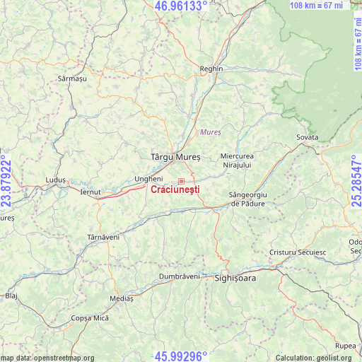
Crăciuneşti GPS coordinates[2]
46° 28' 45.48" North, 24° 34' 56.424" East
| Map corner | latitude | longitude |
|---|---|---|
| Upper-left | 46.96133°, | 23.87922° |
| Center: | 46.4793°, | 24.58234° |
| Lower-right: | 45.99296°, | 25.28547° |
| Map W x H: | 107.7×107.7 km | = 66.9×66.9mi |
| max Lat: | 48.23793° ⇑33.4% North |
| Crăciuneşti: | 46.4793° |
| min Lat: | ⇓66.6% South 43.65638° |
| min Long | Crăciuneşti | max Long |
| 20.31667° | 24.58234° | 29.65403° |
| W 40.9%⇐ | ⇒59.1% E |
Elevation
Elevation of Crăciuneşti is 311 m = 1020 ft, and this is 56.1 m = 184 ft above average elevation for this country.
| Max E: |
1278 m = 4193 ft | 31.2% |
| Crăciuneşti | 311 m 1020 ft | |
| Avg. | 254.9 m = 836 ft | |
Min E: |
-2 m = -7 ft | 68.8% |
See also: Romania elevation on elevation.city.
Geographical zone
Crăciuneşti is located in North temperate zone (between Tropic of Cancer and the Arctic Circle). Distance of this North polar circle is 2233.2 km =1387.6 mi to North.| Distance of | km | miles | from Crăciuneşti |
|---|---|---|---|
| North Pole | 4839 | 3006.8 | to North |
| Arctic Circle | 2233.2 | 1387.6 | to North |
| Tropic Cancer | 2562.1 | 1592 | to South |
| Equator | 5168 | 3211.2 | to South |


Nearby cities:
15 places around Crăciuneşti: (largest is in red/bold)
• Acăţari
3.9 km =2.4 mi,  89°
89°
• Cornești
2.7 km =1.7 mi,  177°
177°
• Coroisânmartin
8.9 km =5.5 mi,  171°
171°
• Corunca
5.4 km =3.4 mi,  30°
30°
• Cristeşti
7.9 km =4.9 mi,  286°
286°
• Gheorghe Doja
6.5 km =4 mi,  257°
257°
• Livezeni
8.8 km =5.5 mi, 26°
• Nazna
8.8 km =5.5 mi,  315°
315°
• Odrihei
8.4 km =5.2 mi,  187°
187°
• Păsăreni
9 km =5.6 mi, 87°
• Satu Nou
5.9 km =3.7 mi,  245°
245°
• Sâncraiu de Mureş
9.1 km =5.7 mi,  331°
331°
• Tirimia
7.7 km =4.8 mi,  244°
244°
• Târgu-Mureş
7.3 km =4.5 mi,  344°
344°
• Ungheni
8.9 km =5.5 mi,  272°
272°
Sources, notices
• [Note1] Compared only with cities in Romania existing in our database
• [Src1] Map data: © OpenStreetMap contributors (CC-BY-SA)
• [Src2] Other city data from geonames.org with taken over terms of usage.
• [Src3] Geographical zone / Annual Mean Temperature by Robert A. Rohde @ Wikipedia
