Chinari geodata
Chinari (Mureş) is a populated place; located in Romania in Europe/Bucharest (GMT+3) time zone. With population of 567 people, there are 6452 cities with bigger population in this country. Compared to other cities in Romania, 69.5% of cities are located further ↓South; 59% of cities are located further →East and 70.4% of cities have lower elevation than Chinari. Note1


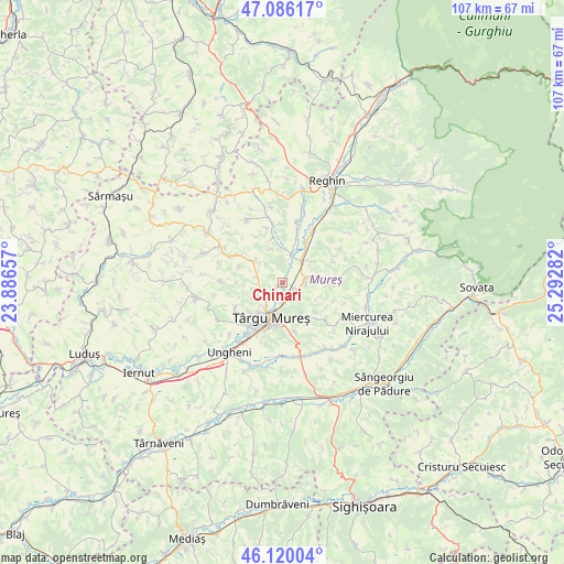
Chinari GPS coordinates[2]
46° 36' 18.936" North, 24° 35' 22.884" East
| Map corner | latitude | longitude |
|---|---|---|
| Upper-left | 47.08617°, | 23.88657° |
| Center: | 46.60526°, | 24.58969° |
| Lower-right: | 46.12004°, | 25.29282° |
| Map W x H: | 107.4×107.4 km | = 66.7×66.7mi |
| max Lat: | 48.23793° ⇑30.5% North |
| Chinari: | 46.60526° |
| min Lat: | ⇓69.5% South 43.65638° |
| min Long | Chinari | max Long |
| 20.31667° | 24.58969° | 29.65403° |
| W 41%⇐ | ⇒59% E |
Elevation
Elevation of Chinari is 324 m = 1063 ft, and this is 69.1 m = 227 ft above average elevation for this country.
| Max E: |
1278 m = 4193 ft | 29.6% |
| Chinari | 324 m 1063 ft | |
| Avg. | 254.9 m = 836 ft | |
Min E: |
-2 m = -7 ft | 70.4% |
See also: Romania elevation on elevation.city.
Geographical zone
Chinari is located in North temperate zone (between Tropic of Cancer and the Arctic Circle). Distance of this North polar circle is 2219.2 km =1378.9 mi to North.| Distance of | km | miles | from Chinari |
|---|---|---|---|
| North Pole | 4825 | 2998.1 | to North |
| Arctic Circle | 2219.2 | 1378.9 | to North |
| Tropic Cancer | 2576.1 | 1600.7 | to South |
| Equator | 5182 | 3219.9 | to South |


Nearby cities:
15 places around Chinari: (largest is in red/bold)
• Ceuașu de Câmpie
6.4 km =4 mi,  299°
299°
• Corunca
9.6 km =6 mi,  167°
167°
• Curteni
1.7 km =1.1 mi,  222°
222°
• Ernei
4 km =2.5 mi,  90°
90°
• Glodeni
5 km =3.1 mi,  8°
8°
• Gorneşti
8.6 km =5.3 mi,  31°
31°
• Livezeni
7 km =4.3 mi,  151°
151°
• Nazna
10.2 km =6.3 mi, 220°
• Păingeni
8.6 km =5.3 mi,  345°
345°
• Pănet
10.7 km =6.6 mi,  238°
238°
• Remetea
6.8 km =4.2 mi, 239°
• Sâncraiu de Mureş
7.7 km =4.8 mi, 218°
• Sângeorgiu de Mureş
4 km =2.5 mi, 174°
• Sântana de Mureş
5.3 km =3.3 mi, 215°
• Târgu-Mureş
7.4 km =4.6 mi,  199°
199°
Sources, notices
• [Note1] Compared only with cities in Romania existing in our database
• [Src1] Map data: © OpenStreetMap contributors (CC-BY-SA)
• [Src2] Other city data from geonames.org with taken over terms of usage.
• [Src3] Geographical zone / Annual Mean Temperature by Robert A. Rohde @ Wikipedia
