Tătărăști geodata
Tătărăști (Bacău) is a seat of a second-order administrative division; located in Romania in Europe/Bucharest (GMT+3) time zone. With population of 417 people, there are 7035 cities with bigger population in this country. Compared to other cities in Romania, 59.9% of cities are located further ↓South; 86.8% of cities are located further ←West and 52.9% of cities have lower elevation than Tătărăști. Note1


Tătărăști GPS coordinates[2]
46° 13' 0.012" North, 27° 12' 0" East
| Map corner | latitude | longitude |
|---|---|---|
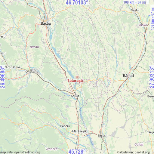
| Upper-left | 46.70103°, | 26.49688° |
| Center: | 46.21667°, | 27.2° |
| Lower-right: | 45.728°, | 27.90313° |
| Map W x H: | 108.2×108.2 km | = 67.2×67.2mi |
| max Lat: | 48.23793° ⇑40.1% North |
| Tătărăști: | 46.21667° |
| min Lat: | ⇓59.9% South 43.65638° |
| min Long | Tătărăști | max Long |
| 20.31667° | 27.2° | 29.65403° |
| W 86.8%⇐ | ⇒13.2% E |
Elevation
Elevation of Tătărăști is 227 m = 745 ft, and this is 27.9 m = 92 ft below average elevation for this country.
| Max E: |
1278 m = 4193 ft | 47.1% |
| Avg. | 254.9 m = 836 ft | |
| Tătărăști | 227 m = 745 ft | |
Min E: |
-2 m = -7 ft | 52.9% |
See also: Romania elevation on elevation.city.
Geographical zone
Tătărăști is located in North temperate zone (between Tropic of Cancer and the Arctic Circle). Distance of this North polar circle is 2262.4 km =1405.8 mi to North.| Distance of | km | miles | from Tătărăști |
|---|---|---|---|
| North Pole | 4868.2 | 3025 | to North |
| Arctic Circle | 2262.4 | 1405.8 | to North |
| Tropic Cancer | 2532.9 | 1573.9 | to South |
| Equator | 5138.8 | 3193.1 | to South |


Nearby cities:
15 places around Tătărăști: (largest is in red/bold)
• Adjudu Vechi
9.1 km =5.7 mi,  185°
185°
• Berești
4.5 km =2.8 mi,  250°
250°
• Corbasca
7.8 km =4.8 mi,  340°
340°
• Cornii de Sus
1.3 km =0.8 mi,  276°
276°
• Căuia
9.6 km =6 mi,  41°
41°
• Fundoaia
10.4 km =6.5 mi,  1°
1°
• Homocea
9.6 km =6 mi,  164°
164°
• Huruiești
6.8 km =4.2 mi,  34°
34°
• Lespezi
7 km =4.3 mi,  153°
153°
• Negulești
7.2 km =4.5 mi,  77°
77°
• Păncești
10.2 km =6.3 mi,  266°
266°
• Sascut
7.9 km =4.9 mi,  256°
256°
• Schineni
7.9 km =4.9 mi, 251°
• Scărișoara
9.2 km =5.7 mi,  323°
323°
• Șișcani
7.5 km =4.7 mi,  197°
197°
Sources, notices
• [Note1] Compared only with cities in Romania existing in our database
• [Src1] Map data: © OpenStreetMap contributors (CC-BY-SA)
• [Src2] Other city data from geonames.org with taken over terms of usage.
• [Src3] Geographical zone / Annual Mean Temperature by Robert A. Rohde @ Wikipedia
