Huruiești geodata
Huruiești (Bacău) is a seat of a second-order administrative division; located in Romania in Europe/Bucharest (GMT+3) time zone. With population of 801 people, there are 5041 cities with bigger population in this country. Compared to other cities in Romania, 61.1% of cities are located further ↓South; 87.5% of cities are located further ←West and 63.4% of cities have lower elevation than Huruiești. Note1


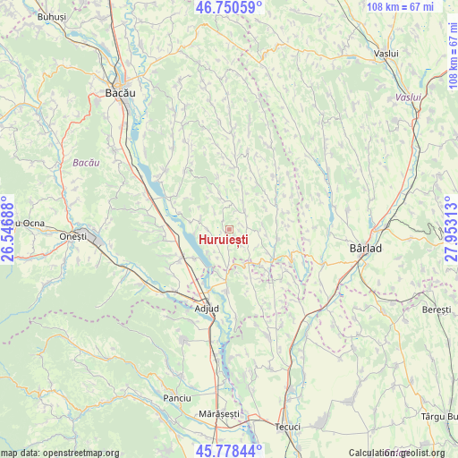
Huruiești GPS coordinates[2]
46° 16' 0.012" North, 27° 15' 0" East
| Map corner | latitude | longitude |
|---|---|---|
| Upper-left | 46.75059°, | 26.54688° |
| Center: | 46.26667°, | 27.25° |
| Lower-right: | 45.77844°, | 27.95313° |
| Map W x H: | 108.1×108.1 km | = 67.2×67.2mi |
| max Lat: | 48.23793° ⇑38.9% North |
| Huruiești: | 46.26667° |
| min Lat: | ⇓61.1% South 43.65638° |
| min Long | Huruiești | max Long |
| 20.31667° | 27.25° | 29.65403° |
| W 87.5%⇐ | ⇒12.5% E |
Elevation
Elevation of Huruiești is 281 m = 922 ft, and this is 26.1 m = 86 ft above average elevation for this country.
| Max E: |
1278 m = 4193 ft | 36.6% |
| Huruiești | 281 m 922 ft | |
| Avg. | 254.9 m = 836 ft | |
Min E: |
-2 m = -7 ft | 63.4% |
See also: Romania elevation on elevation.city.
Geographical zone
Huruiești is located in North temperate zone (between Tropic of Cancer and the Arctic Circle). Distance of this North polar circle is 2256.8 km =1402.3 mi to North.| Distance of | km | miles | from Huruiești |
|---|---|---|---|
| North Pole | 4862.7 | 3021.5 | to North |
| Arctic Circle | 2256.8 | 1402.3 | to North |
| Tropic Cancer | 2538.5 | 1577.4 | to South |
| Equator | 5144.4 | 3196.6 | to South |


Nearby cities:
15 places around Huruiești: (largest is in red/bold)
• Băcioiu
8.9 km =5.5 mi,  306°
306°
• Corbasca
6.7 km =4.2 mi,  286°
286°
• Cornii de Sus
7.5 km =4.7 mi,  223°
223°
• Căuia
3 km =1.9 mi,  55°
55°
• Dealu Morii
5.7 km =3.5 mi,  347°
347°
• Frumușelu
7.9 km =4.9 mi,  80°
80°
• Fundoaia
6.1 km =3.8 mi,  323°
323°
• Glăvăneşti
10.4 km =6.5 mi,  100°
100°
• Găiceana
7.8 km =4.8 mi,  340°
340°
• Negulești
5.1 km =3.2 mi,  141°
141°
• Scărișoara
9.5 km =5.9 mi,  281°
281°
• Sârbi
7.9 km =4.9 mi,  120°
120°
• Tătărăști
6.8 km =4.2 mi,  214°
214°
• Vâlcele
10.3 km =6.4 mi,  296°
296°
• Țepoaia
10 km =6.2 mi, 59°
Sources, notices
• [Note1] Compared only with cities in Romania existing in our database
• [Src1] Map data: © OpenStreetMap contributors (CC-BY-SA)
• [Src2] Other city data from geonames.org with taken over terms of usage.
• [Src3] Geographical zone / Annual Mean Temperature by Robert A. Rohde @ Wikipedia
