Stroești geodata
Stroești (Arges) is a populated place; located in Romania in Europe/Bucharest (GMT+3) time zone. With population of 1,190 people, there are 3764 cities with bigger population in this country. Compared to other cities in Romania, 64.3% of cities are located further ↑North; 55.6% of cities are located further →East and 84.4% of cities have lower elevation than Stroești. Note1


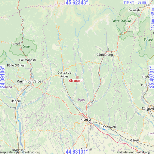
Stroești GPS coordinates[2]
45° 7' 46.308" North, 24° 47' 39.048" East
| Map corner | latitude | longitude |
|---|---|---|
| Upper-left | 45.62343°, | 24.09106° |
| Center: | 45.12953°, | 24.79418° |
| Lower-right: | 44.63131°, | 25.49731° |
| Map W x H: | 110.3×110.3 km | = 68.5×68.5mi |
| max Lat: | 48.23793° ⇑64.3% North |
| Stroești: | 45.12953° |
| min Lat: | ⇓35.7% South 43.65638° |
| min Long | Stroești | max Long |
| 20.31667° | 24.79418° | 29.65403° |
| W 44.4%⇐ | ⇒55.6% E |
Elevation
Elevation of Stroești is 439 m = 1440 ft, and this is 184.1 m = 604 ft above average elevation for this country.
| Max E: |
1278 m = 4193 ft | 15.6% |
| Stroești | 439 m 1440 ft | |
| Avg. | 254.9 m = 836 ft | |
Min E: |
-2 m = -7 ft | 84.4% |
See also: Romania elevation on elevation.city.
Geographical zone
Stroești is located in North temperate zone (between Tropic of Cancer and the Arctic Circle). Distance of this North polar circle is 2383.2 km =1480.9 mi to North.| Distance of | km | miles | from Stroești |
|---|---|---|---|
| North Pole | 4989.1 | 3100.1 | to North |
| Arctic Circle | 2383.2 | 1480.9 | to North |
| Tropic Cancer | 2412 | 1498.7 | to South |
| Equator | 5017.9 | 3118 | to South |


Nearby cities:
15 places around Stroești: (largest is in red/bold)
• Bădești
7 km =4.3 mi,  48°
48°
• Coşeşti
9 km =5.6 mi,  140°
140°
• Curtea de Argeş
9.4 km =5.8 mi,  273°
273°
• Domneşti
8.4 km =5.2 mi,  21°
21°
• Gănești
3.7 km =2.3 mi,  102°
102°
• Jupânești
8.2 km =5.1 mi,  147°
147°
• Leicești
6.4 km =4 mi,  125°
125°
• Mușătești
9.7 km =6 mi,  353°
353°
• Mălureni
3.3 km =2.1 mi,  172°
172°
• Pietroşani
7.4 km =4.6 mi,  36°
36°
• Păcioiu
7.7 km =4.8 mi, 133°
• Retevoiești
3.6 km =2.2 mi,  71°
71°
• Robaia
9.7 km =6 mi, 353°
• Toplița
6.5 km =4 mi,  227°
227°
• Valea Iaşului
8.5 km =5.3 mi,  314°
314°
Sources, notices
• [Note1] Compared only with cities in Romania existing in our database
• [Src1] Map data: © OpenStreetMap contributors (CC-BY-SA)
• [Src2] Other city data from geonames.org with taken over terms of usage.
• [Src3] Geographical zone / Annual Mean Temperature by Robert A. Rohde @ Wikipedia
